mail_outline sales@mediastorehouse.com
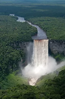
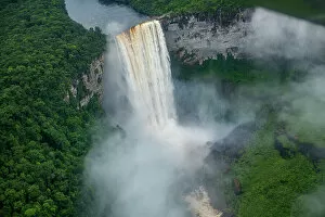
Aerial view of Kaieteur Falls and the Potaro River in full spate, Guyana, South America
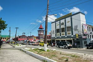
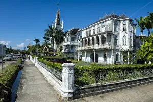
Downtown, Georgetown, Guyana, South America
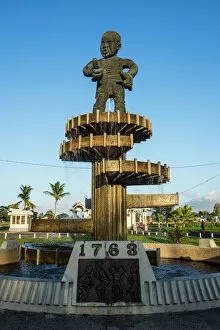
Cuffy Monument of the revolution of 1763, Georgetown, Guyana, South America
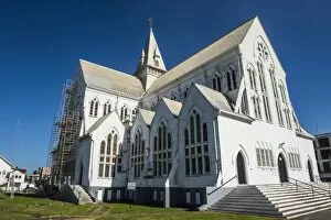
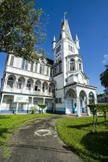
St. Georges Cathedral, one of the largest wooden churches in the world, Georgetown, Guyana, South America
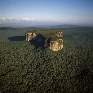
Aerial image of Ayangaik mountain, Upper Mazaruni District, Guyana, South America
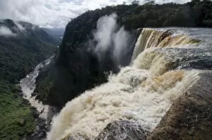
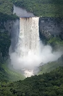
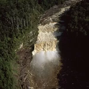
Aerial of the Kaieteur Falls, Potaro River, Guyana, South America
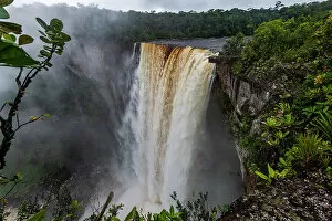
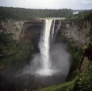
Kaieteur Falls, Potaro River, Guyana, South America
Colonial building in Georgetown, Guyana, South America
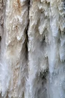
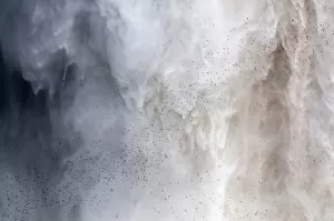
Detail of water falling from Kaieteur Falls, Guyana, South America
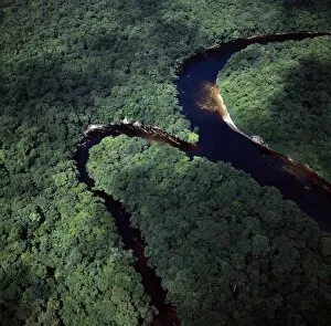
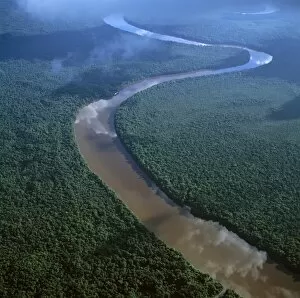
Aerial image of the confluence of Paikwa River with Kako River, Upper Mazaruni District, Guyana, South America
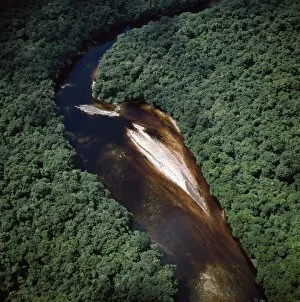
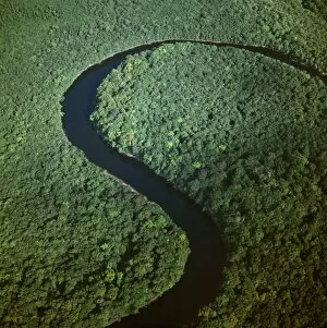
Aerial image of river bend and sandbars in the Paikwa River, Upper Mazaruni District, Guyana, South America
Botanical garden, Georgetown, Guyana, South America
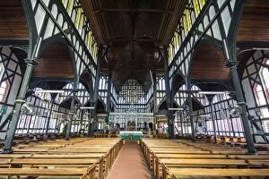
Interior of the St. Georges Cathedral, one of the largest wooden churches in the world, Georgetown, Guyana, South America
Historic Town Hall, Georgetown, Guyana, South America
Flock of swifts flying to their roost behind the curtain of falling water of Kaieteur Falls, Guyana, South America
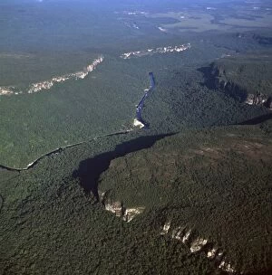
View from the Kaieteur Falls rim into the Potaro River Gorge, Guyana, South America
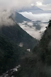
Low cloud in the Potaro River Gorge, Guyana, South America
View across the rim of Kaieteur Falls, Guyana, South America
Aerial view of Kaieteur Falls in full spate, Guyana, South America
Aerial view of mountainous rainforest in Guyana, South America
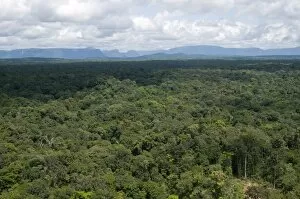
Aerial view over the rainforest of Guyana, South America
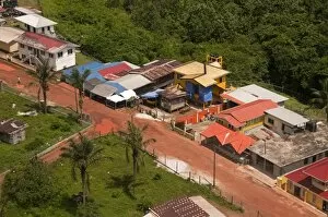
Aerial view of the mining town of Mahdia, Guyana, South America
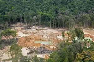
Destruction of rainforest caused by gold mining, Guyana, South America
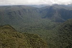
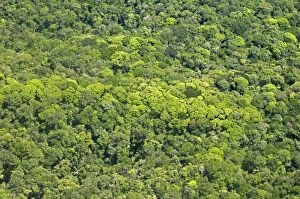
Aerial view of pristine rainforest canopy, Guyana, South America
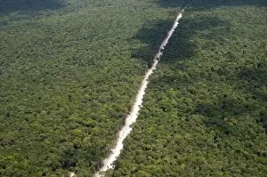
Main highway of Guyana cutting through the rainforest, Guyana, South America
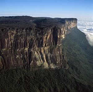
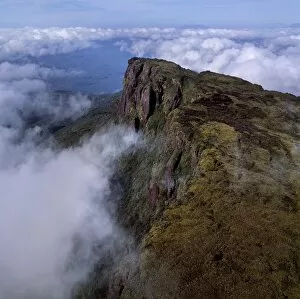
Aerial image of tepuis showing eastern cliff looking towards Brazil and Guyana, Mount Roraima, Venezuela, South America
Aerial image of the Lower Mazaruni River south of Oranapai Landing, Guyana, South America
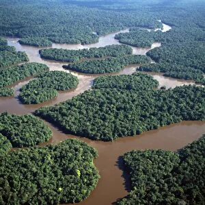
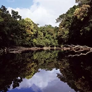
Aerial image of the Lower Mazaruni River with islands of tropical rain forest, Hororabo, near Bartica, Guyana, South America
Aerial image of the Kako River, Upper Mazaruni District, Guyana, South America
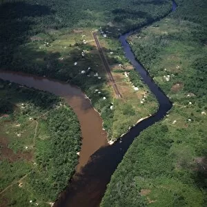
Aerial image of Kamarang Mouth Station and airstrip at the confluence of the unpolluted Kamarang River with the mined and heavily polluted Upper Mazaruni River in March 2005, Guyana, South America
Aerial image of the Upper Mazaruni River, downstream from Kamarang, Guyana, South America
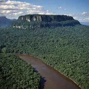
Aerial image of Ayanganna Mountain, Guyana, South America
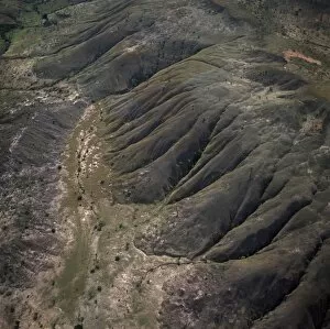
Aerial view of highland savannah and erosion, near Ireng River, Rupununi District, Guyana, South America
Kaieteur Falls, Potaro River, dry season, Guyana, South Amrica
Aerial image of Chi-Chi Gorge, downstream from Chi-Chi Falls, Upper Mazaruni River, Upper Mazaruni District, Guyana, South America
Aerial image of the Peaima Falls, Upper Mazaruni River, Guyana, South America
Kamarang River, Upper Mazaruni District, Guyana, South America
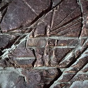
Red jasper rock at Orinduik Falls, Ireng River, Guyana, South America
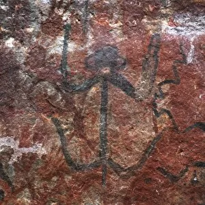
Karowrieng rock paintings, Chi-Chi Gorge, Upper Mazaruni District, Guyana, South America
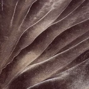
Eroded sandstone, Kamarang Station, Upper Mazaruni District, Guyana, South America