mail_outline sales@mediastorehouse.com
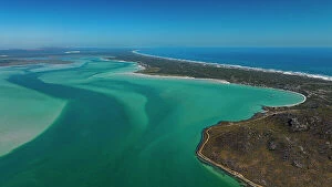
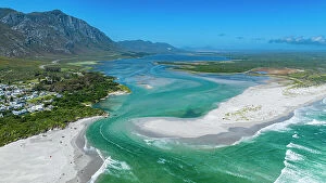
Aerial of the Langebaan Lagoon Marine Protected Area, West Coast National Park, Western Cape Province, South Africa, Africa
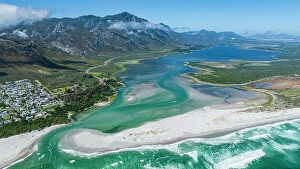
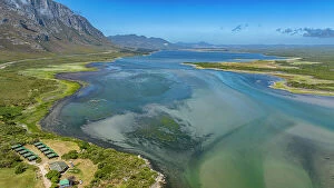
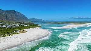
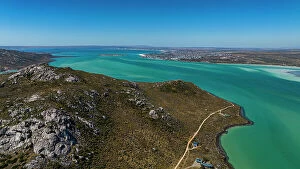
Aerial of the Klein River Lagoon, Hermanus, Western Cape Province, South Africa, Africa
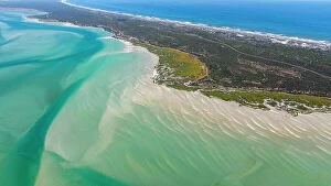
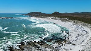
Aerial of a white sandy beach, West Coast National Park, Western Cape Province, South Africa, Africa
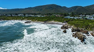
Aerial of Hermanus, Western Cape Province, South Africa, Africa
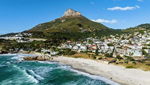
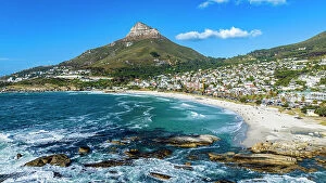
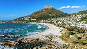
Aerial of the Lion Head and Camps Bay, Cape Town, South Africa, Africa
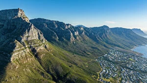
Aerial of the Table Mountain and the Twelve Apostles, Cape Town, South Africa, Africa
Aerial of the Lion's Head and Camps Bay, Cape Town, South Africa, Africa
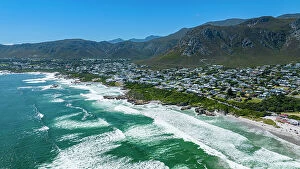
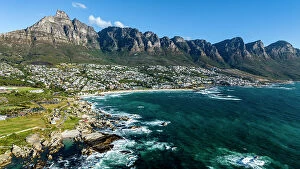
Aerial of the Twelve Apostles and Camps Bay, Cape Town, South Africa, Africa
Aerial view of red rorbu cabins in a row amidst the cold sea in winter, Svolvaer, Nordland county, Lofoten Islands, Norway, Scandinavia, Europe
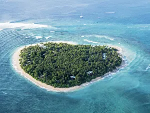
Aerial view of the heart-shaped island of Tavarua, near Viti Levu, Republic of Fiji, South Pacific Islands, Pacific
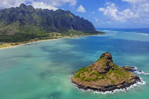
Aerial view by drone of Kaneohe Bay and Mokolii island (Chinamans Hat), Oahu Island, Hawaii, United States of America, North America
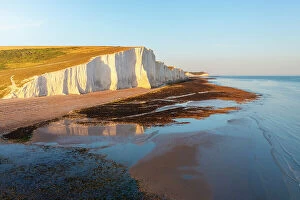
Aerial view of Seven Sisters chalk cliffs at sunset, South Downs National Park, East Sussex, England, United Kingdom, Europe
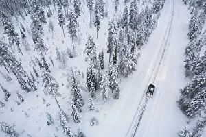
Aerial shot of a car crossing the boreal forest covered with snow, Akaslompolo, Finnish Lapalnd, Finland, Scandinavia, Europe
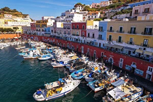
Aerial view of the colorful Italian village of Ponza with fishing vessels in the foreground, Pontine Islands, Latina province, Tyrrhenian Sea, Latium (Lazio), Italy, Europe
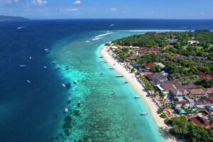
Aerial view of Gili Trawangan beach with boats anchored in the ocean, Gili Trawangan, Gili Islands archipelago, Lombok, West Nusa Tenggara, Indian Ocean, Indonesia, Southeast Asia, Asia
Traditional and colorful fishing town of Ponza seen from above at sunset, Pontine archipelago, Latina province, Tyrrhenian Sea, Latium (Lazio), Italy Europe
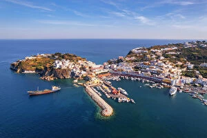
Aerial view of the blue water around the harbour of Ponza island on a sunny day, Pontine archipelago, Latina province, Tyrrhenian Sea, Latium (Lazio), Italy Europe
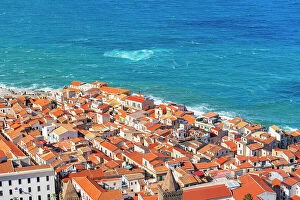
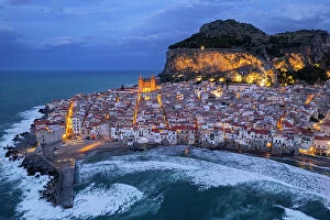
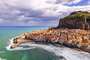
The old fishing village of Cefalu with red roofs and white houses seen from above, Palermo province, Tyrrhenian Sea, Sicily, Italy, Mediterranean, Europe
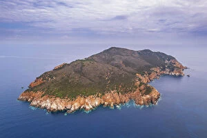
Drone view of Zannone island on a cloudy day, Zannone island, Ponza municipality, Circeo National Park, Pontine archipelago, Tyrrhenian sea, Latina province, Latium (Lazio), Italy Europe
Sunset above Gavi island with Zannone island in the background, aerial view, Ponza municipality, Circeo National Park, Pontine archipelago, Tyrrhenian sea, Latina province, Latium (Lazio)
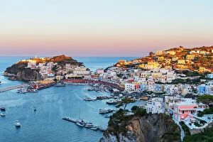
Aerial view of the island of Ponza with typical moon shape at dusk, Pontine archipelago, Latina province, Tyrrhenian Sea, Latium (Lazio), Italy Europe
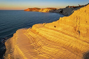
Aerial shot of Scala dei Turchi staircase seen from a drone at sunrise, Realmonte, Agrigento province, Sicily, Italy, Mediterranean, Europe
Aerial morning view of the white lighthouse of Capo Murro di Porco on the peninsula Maddalena, Plemmirio Marine Park, Ionian Sea, Syracuse province, Sicily, Italy, Mediterranean, Europe
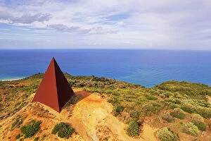
Aerial of the iron pyramid of Parallel 38 against the sea, Fiumara d'Arte, Motta d'Affermo, Nebrodi mountains, Messina province, Sicily, Italy, Mediterranean, Europe
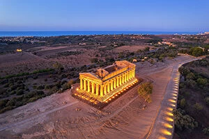
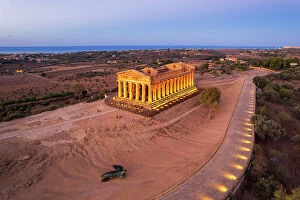
The illuminated Temple of Concordia seen from a drone at dawn, Valley of the Temples, UNESCO World Heritage Site, Agrigento, Sicily, Italy, Mediterranean, Europe
The illuminated fishing village of Cefalu with the rock on top of the old town seen from the drone at dusk, Cefalu, Palermo province, Tyrrhenian Sea, Sicily, Italy, Mediterranean, Europe
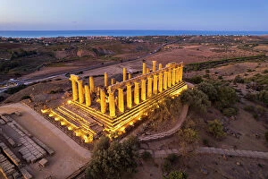
The illuminated Greek Temple of Hera seen from a drone, Valley of the Temples, UNESCO World Heritage Site, Agrigento, Sicily, Italy, Mediterranean, Europe
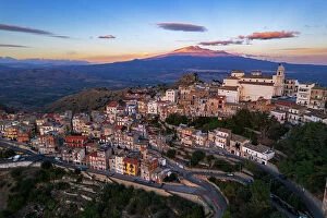
Aerial view of the old village of Centuripe with Mount Etna volcano Etna covered with snow and lit from the sunset, Centuripe, Enna province, Sicily, Italy, Mediterranean, Europe
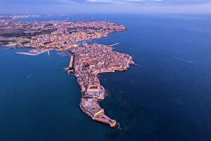
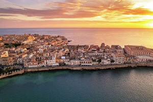
Aerial shot of Syracuse and the old city on the island of Ortigia at dawn, UNESCO World Heritage Site, Syracuse province, Ioanian sea, Sicily, Italy, Mediterranean, Europe
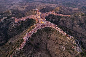
Aerial view of Centuripe, the human-shaped or star-shaped town, seen from above at dusk, Centuripe, Enna province, Sicily, Italy, Mediterranean, Europe
Aerial view of the old white village of Cefalu on a cloudy day, aerial view, Cefalu, Palermo province, Tyrrhenian Sea, Sicily, Italy, Mediterranean, Europe
Aerial morning view of the old and fortified town Syracuse, UNESCO World Heritage Site, Ortigia island, Syracuse province, Ioanian sea, Sicily, Italy, Mediterranean, Europe
Illuminated Concordia Greek Temple seen from above at dawn, Valley of the Temples, UNESCO World Heritage Site, Agrigento, Sicily, Italy, Mediterranean, Europe
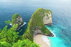
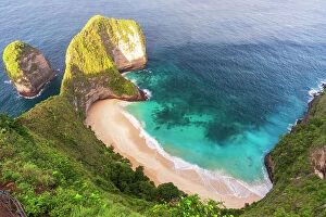
View from above of the famous empty Kelingking white sandy beach (T-Rex Beach), Nusa Penida island, Klungkung regency, Bali, Indonesia, Southeast Asia, Asia
Kelingking white and sandy beach (T-Rex Beach) seen from above at sunrise, Nusa Penida island, Klungkung regency, Bali, Indonesia, Southeast Asia, Asia
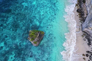
Aerial view of Suwehan white sandy beach with turquoise sea water and the big rock (sea stack) in the sea seen from a drone, Nusa Penida, Klungkung regency, Bali, Indonesia, Southeast Asia, Asia
Aerial view of a car driving through the snow covered forest on icy road, Akaslompolo, Finnish Lapland, Finland, Scandinavia, Europe
Aerial drone panoramic view of Braga, known for its religious heritage including Bom Jesus do Monte complex, and medieval Braga Cathedral, home to a Sacred Art Museum and Gothic-style Kings Chapel
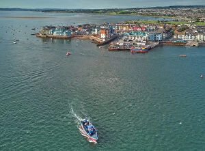
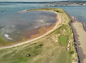
Aerial view of the mouth of the River Exe, looking towards the town of Exmouth, Devon, England, United Kingdom, Europe
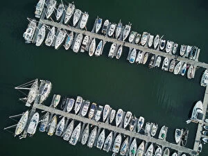
An aerial view looking straight down of yachts tied up in the Dart Marina, on the River Dart, Kingswear, on the south coast of Devon, England, United Kingdom, Europe
Aerial view of the mouth of the River Exe, seen from above Dawlish Warren and looking towards the town of Exmouth, Devon, England, United Kingdom, Europe