mail_outline sales@mediastorehouse.com
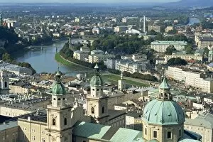
City view from the Fortress, Salzburg, Austria, Europe
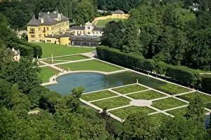
Schloss Hellbrunn pleasure gardens, near Salzburg, Austria, Europe
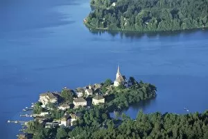
Maria Worth from Pyramidenkogel, Lake Worther, Carinthia, Austria, Europe
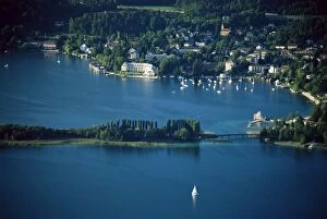
View of Portschach, Lake Worther, Carinthia, Austria, Europe
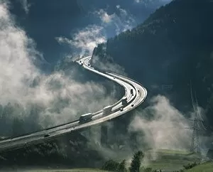
Cloud on either side of elevated road at the Brenner Pass in Austria, Europe
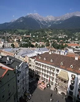
Old Town with Goldenes Dachl, Innsbruck, Austria, Europe
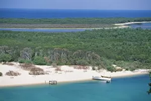
Lakes Entrance, the sea mouth of the Lakes District, Australias largest inland waterway, on coast of Gippsland, Victoria, Australia, Pacific
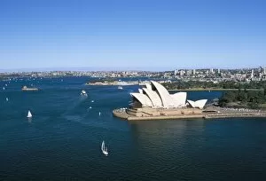
Aerial view of Sydney Opera House and harbour, Sydney, New South Wales, Australia, Pacific
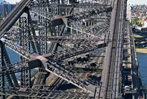
Aerial of a section of the Sydney Harbour Bridge, Sydney, New South Wales, Australia, Pacific
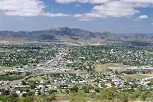
Looking south from Castle Hill in Townsville towards Paluma Range, Queensland, Australia, Pacific
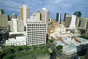
The skyline from City Hall looking towards King George Square and Adelaide Street in Brisbane, Queensland, Australia, Pacific
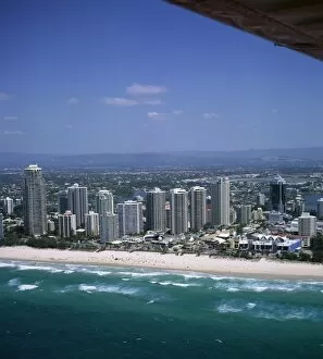
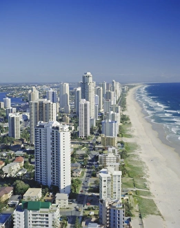
Aerial view of central area of Surfers Paradise, Gold Coast, Queensland, Australia, Pacific
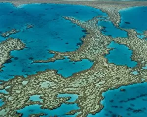
The Great Barrier Reef, Queensland, Australia
Aerial view of Surfers Paradise, the Gold Coast, Queensland, Australia
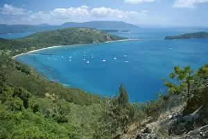
View over Bauer Bay, South Molle Island, Whitsundays, Queensland, Australia, Pacific
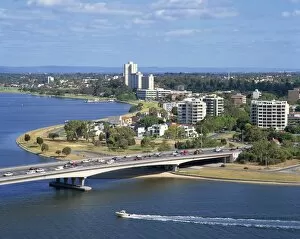
Aerial of the Narrows Bridge in the city of Perth, Western Australia, Australia, Pacific
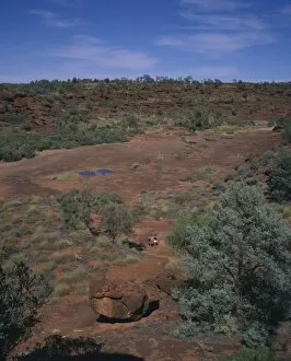
A couple walking through an oasis in a Desert Palm Valley, location of unique varieties of palm tree, in the Alice Springs area of Northern Territory, Australia, Pacific
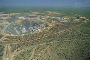
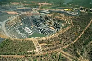
Aerial view of one of only three permitted uranium mines in Australia (share of profits go to aboriginal landowners), Ranger Uranium mine, Kakadu National Park, Northern Territory, Australia
Aerial of Ranger Uranium mine in Kakadu National Park from which a share of the profits go to aboriginal landowners in the Northern Territory of Australia, Pacific
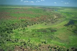
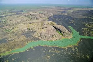
Aerial of wetlands on the floodplain of East Alligator River forming the border beween Arnhemland and Kakadu National Park in Northern Territory, Australia, Pacific
Aerial of a billabong, the backwater of a river on the floodplain of the East Alligator River near the border of Arnhemland and Kakadu National Park, Northern Territory, Australia
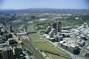
View over the city and Yarra River from the World Trade Centre, Melbourne, Victoria, Australia, Pacific
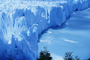
Aerial view of icebergs at Moreno Glacier (Perito Moreno), Parque Nacional Los Glaciares, UNESCO World Heritage Site, Patagonia, Argentina, South America
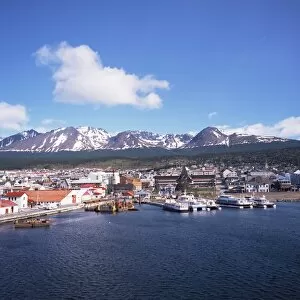
The southernmost port of Ushuaia, Argentina, South America
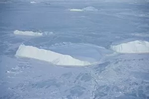
Icebergs seen on heli flight from Russian icebreaker, Kapitan Khlebnikov, Weddell Sea, Antarctica, Polar Regions
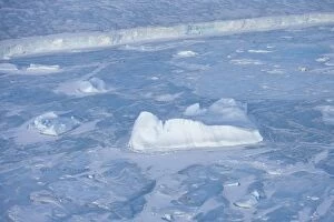
Icebergs and pack ice seen on heli flight from Russian icebreaker, Kapitan Khlebnikov, Weddell Sea, Antarctica, Polar Regions
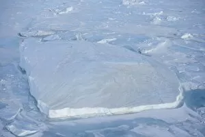
Iceberg and pack ice seen on heli flight from Russian icebreaker, Kapitan Khlebnikov, Weddell Sea, Antarctica, Polar Regions
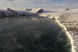
Helicopter flight on Huntress Glacier, False Bay, Livingston Island, South Shetland Islands, Antarctica, Polar Regions
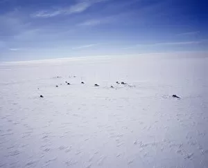
Aerial view of Siple Station, main base is 40ft under the ice, United States Antarctic Program, Antarctica, Polar Regions
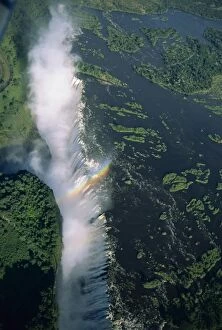
Victoria Falls (Mosi-oa-Tunya), UNESCO World Heritage Site, Zimbabwe, Africa
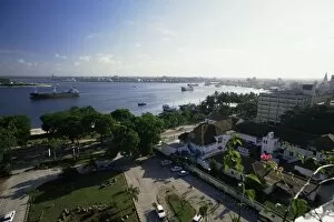
View of the harbour from the Kilimanjaro Hotel on Kivukoni front, Dar es Salaam, Tanzania, East Africa, Africa
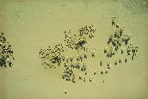
Bilma salt caravan, Niger, Africa
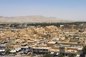
View from The Citadel (Qala-i-Ikhtiyar-ud-din), Herat, Herat Province, Afghanistan, Asia