mail_outline sales@mediastorehouse.com
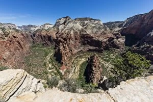
View of the valley floor from Angels Landing Trail in Zion National Park, Utah, United States of America, North America
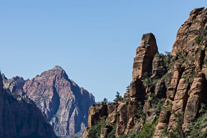
View of Navajo sandstone formations from Angels Landing Trail in Zion National Park, Utah, United States of America, North America
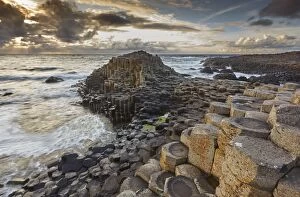
An evening view of the Giants Causeway, UNESCO World Heritage Site, County Antrim, Ulster, Northern Ireland, United Kingdom, Europe
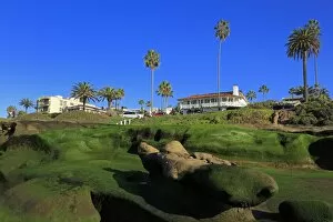
Rock formations, La Jolla, San Diego, California, United States of America, North America
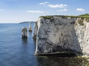
The Chalk cliffs of Ballard Down with The Pinnacles Stack and Stump in Swanage Bay, near Handfast Point, Isle of Purbeck, Jurassic Coast, UNESCO World Heritage Site, Dorset, England, United Kingdom
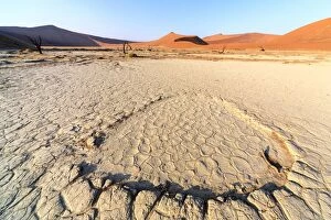
Parched ground and dead Acacia surrounded by sandy dunes, Deadvlei, Sossusvlei, Namib Desert, Namib Naukluft National Park, Namibia, Africa
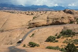
Hummer driving on the Slickrock trail, Moab, Utah, United States of America, North America
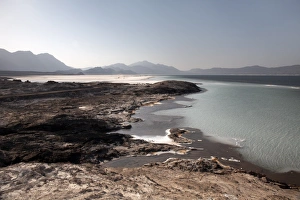
Lake Assal, 151m below sea level, Djibouti, Africa
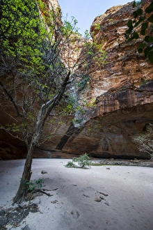
Cathedral Gorge in the Purnululu National Park, UNESCO World Heritage Site, Bungle Bungle mountain range, Western Australia, Australia, Pacific
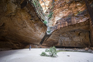
Couple in the Cathedral Gorge in the Purnululu National Park, UNESCO World Heritage Site, Bungle Bungle mountain range, Western Australia, Australia, Pacific
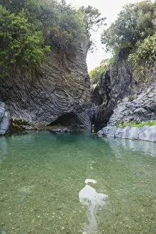
Alcantara River running through the Alcantara Gorge on Mount Etna Volcano, UNESCO World Heritage Site, Sicily, Italy, Europe
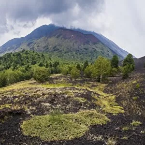
Mount Etna Volcano, old lava flow from an eruption, UNESCO World Heritage Site, Sicily, Italy, Europe
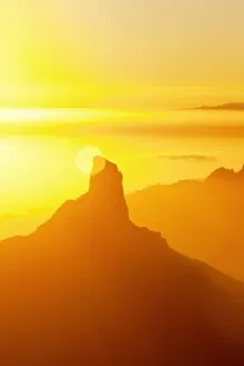
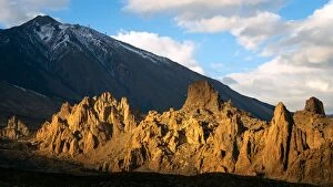
Roque Bentayga and Tenerife in distance, Gran Canaria, Canary Islands, Spain, Atlantic, Europe
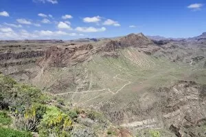
View from Mirador de Fataga to the valley Barranco de Fataga, Gran Canaria, Canary Islands, Spain, Europe
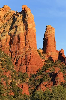
Rock formations in Sedona, Arizona, United States of America, North America
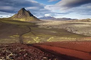
Mount Krakatindur, 858 m, standing solitary in the Nyjahraun lava field, east of Hekla volcano in the distance, Fjallabak route north (Nyrdri-Fjallaback) in the interior, Iceland, Polar Regions
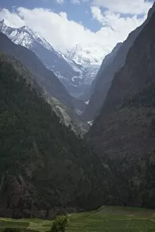
V-shaped valley on road between Darcha and Rohtang Pass, Himachal Pradesh, India, Asia
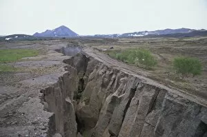
Rift where earth is splitting at plate boundary, Grotagja, Lake Myvatn region, north east area, Iceland, Polar Regions
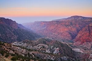
Wadi Dana, Dana Nature Reserve, Jordan, Middle East
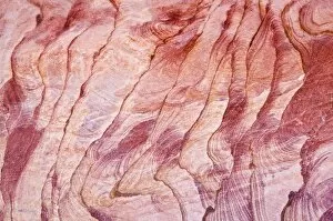
Detail, The Coloured Canyon, near Nuweiba, Sinai, Egypt, North Africa, Africa
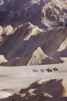
Tourists horse trekking, Valle de la Luna (Valley of the Moon), Atacama Desert, Norte Grande, Chile, South America
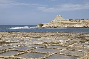
Salt pans at Qbajjar, near Marsalforn, Gozo, Malta, Mediterranean, Europe
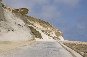
Rock formations at Qbajjar, near Marsalforn, Gozo, Malta, Europe
Earthquake fault line in roadcut, Interstate 40, Kingman, Arizona, United States of America, North America
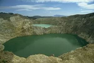
Crater Lakes at Keli Mutu, Moni, Flores, Indonesia, Southeast Asia, Asia
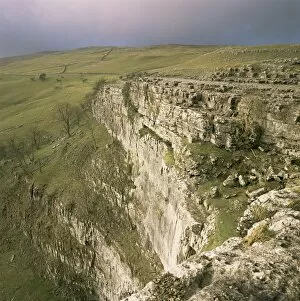
Malham Cove, Yorkshire Dales, North Yorkshire, England, United Kingdom, Europe
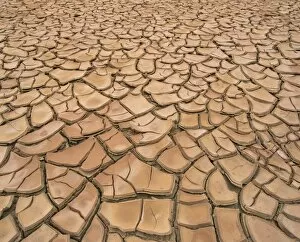
Arid landscape of dry cracked earth in a drought, South Australia, Australia, Pacific
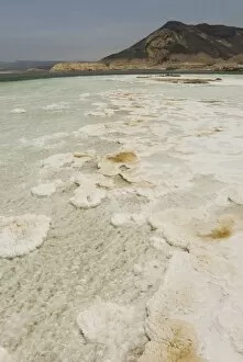
Lac Assal, the lowest point on the African continent and the most saline body of water on earth, Djibouti, Africa
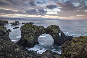
Rock formations, Arnarstapi, Snaefellsnes Peninsula, Iceland, Polar Regions
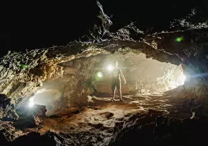
Tourist exploring the Ana Kakenga Cave, Rapa Nui National Park, UNESCO World Heritage Site, Easter Island, Chile, South America
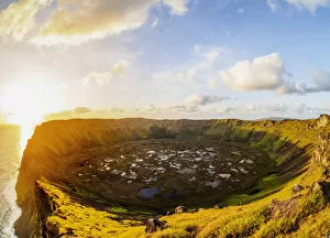
Crater of Rano Kau Volcano at sunset, Easter Island, Chile, South America
Mount Teide volcano at sunset, Mount Teide National Park, UNESCO World Heritage Site, Tenerife, Spain, Europe
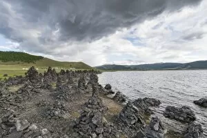
Volcanic rock formations on the shores of White Lake, Tariat district, North Hangay province, Mongolia, Central Asia, Asia
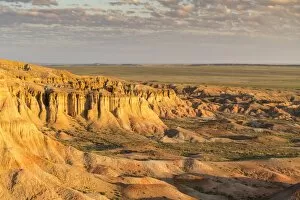
White Stupa in the morning light, Ulziit, Middle Gobi province, Mongolia, Central Asia, Asia