mail_outline sales@mediastorehouse.com
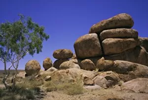
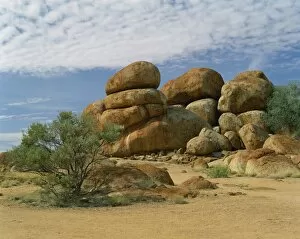
Rounded rock formations, the Pebbles, or Devils Marbles, Northern Territory, Australia
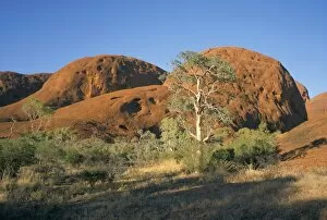
Unusual weathered rock formation, the Olgas, Northern Territory, Australia, Pacific
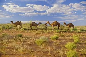
Camels, Central Desert, Northern Territory, Australia
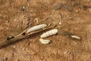
Wichetty grubs, eaten by Aborigines, Northern Territory, Australia, Pacific
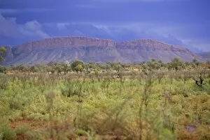
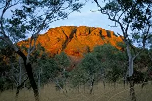
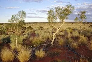
Landscape around Paunya, Northern Territory, Australia
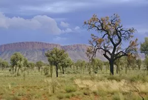
Landscape around Papunya, Northern Territory, Australia
Camel racing, Alice Springs, Northern Territory, Australia, Pacific
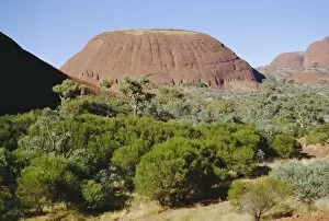
Mount Olga from the west, Northern Territory, Australia
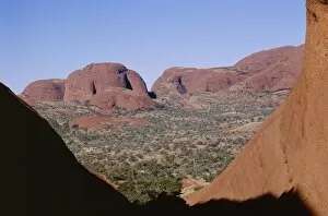
The Olgas, Northern Territory, Australia
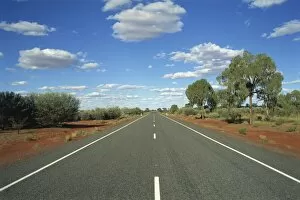
The empty Lasseter Highway in the Northern Territory, Australia, Pacific
Huge boulders known as the Devils Marbles in the Northern Territory, Australia, Pacific
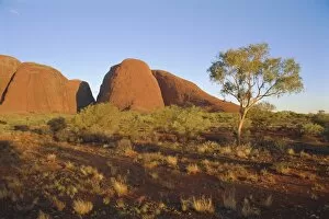
Kata Tjuta, The Olgas, Northern Territory, Australia
Valley of the Winds, Katatjuta (The Olgas), Northern Territory, Australia, Pacific
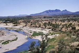
Finke River and Mount Sonder, at 1347m the highest point in Northern Territory, Northern Territory, Australia, Pacific
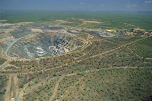
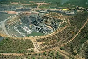
Aerial view of one of only three permitted uranium mines in Australia (share of profits go to aboriginal landowners), Ranger Uranium mine, Kakadu National Park, Northern Territory, Australia
Aerial of Ranger Uranium mine in Kakadu National Park from which a share of the profits go to aboriginal landowners in the Northern Territory of Australia, Pacific
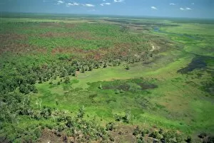
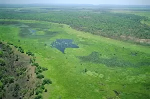
Aerial of wetlands on the floodplain of East Alligator River forming the border beween Arnhemland and Kakadu National Park in Northern Territory, Australia, Pacific
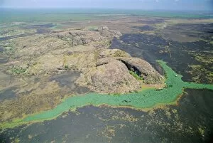
Aerial of a billabong, the backwater of a river on the floodplain of the East Alligator River near the border of Arnhemland and Kakadu National Park, Northern Territory, Australia
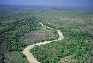
The East Alligator River that forms the border between Arnhemland and Kakadu National Park, the river forms lush wetlands in the wet season, Northern Territory, Australia
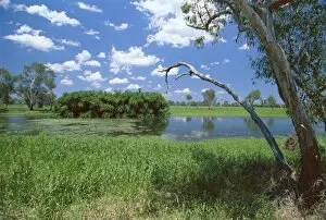
The Yellow Water wetlands on floodplain of the Alligator River, Kakadu National Park, UNESCO World Heritage Site, Northern Territory, Australia, Pacific
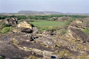
Part of Nouriangie Rock, sacred Aboriginal shelter and rock art site in north east of national park and part of escarpment bordering park, Kakadu National Park, Northern Territory, Australia
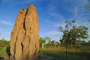
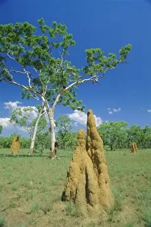
Termite cathedral by the Arnhem Highway near the Mary River Crossing between Darwin and Kakadu at The Top End, Northern Territory, Australia
View from Ublrr Rock, aboriginal rock art site, part of the sandstone escarpment on park border, Kakadu National Park, UNESCO World Heritage Site, Northern Territory, Australia, Pacific
Huge termite nests or cathedrals at The Top End, Kakadu National Park, Northern Territory, Australia
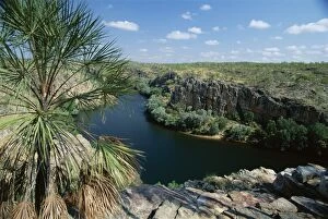
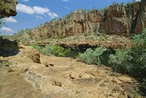
The western end of Katherine Gorge in Nitmiluk National Park, where Katherine River cuts through a sandstone plateau, The Top End, Northern Territory, Australia, Pacific
Wetlands on the floodplain of the East Alligator River that forms the border between Arnhemland and Kakadu National Park, Northern Territory, Australia
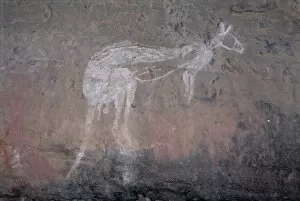
Painting of a kangaroo at Nourlangie Rock, the sacred aboriginal shelter and rock art site in the north east of Kakadu National Park, UNESCO World Heritage Site, Northern Territory, Australia, Pacific
Painting of dancing figures at Nourlangie Rock, sacred aboriginal shelter and rock art site in the north east of Kakadu National Park, UNESCO World Heritage Site, Northern Territory, Australia
Western end of Katherine Gorge where Katherine River cuts through sandstone plateau at The Top End, Nitmiluk National Park, Northern Territory, Australia
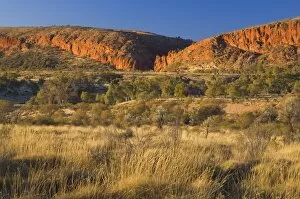
Glen Helen Gorge, West MacDonnell National Park, Northern Territory, Australia, Pacific
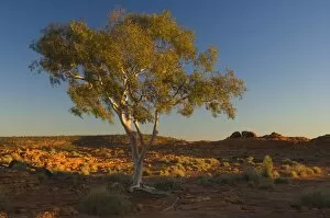
Ghost gum tree, Watarrka National Park, Northern Territory, Australia, Pacific
Keep River National Park, Northern Territory, Australia, Pacific
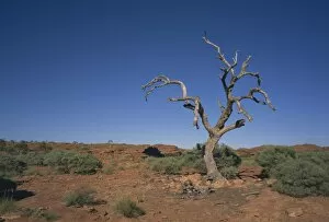
Arid landscape with dead tree in Kings Canyon, Watarrka National Park, Northern Territory, Australia, Pacific
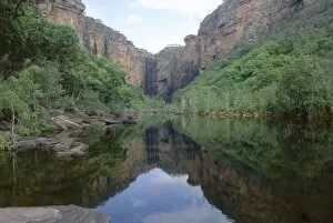
Reflections in still water, Jim Jim Falls and Creek, Kakadu National Park, UNESCO World HeritageSite, Northern Territory, Australia, Pacific
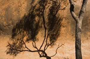
Shadow of tree on Uluru (Ayers Rock), Uluru-Kata Tjuta National Park, Northern Territory, Australia, Pacific
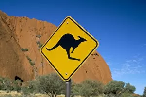
Kangaroo road sign at Uluru (Ayers Rock), Uluru-Kata Tjuta National Park, Northern Territory, Australia, Pacific
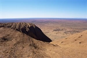
View from Ayers Rock (Uluru), Uluru-Kata Tjuta National Park, UNESCO World Heritage Site, Northern Territory, Australia, Pacific
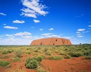
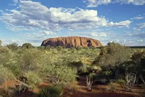
Ayers Rock, Uluru National Park, Northern Territory, Australia
Ayers Rock, Northern Territory, Australia
Red Centre landscape near Uluru, Yulara, Northern Territory, Australia