mail_outline sales@mediastorehouse.com
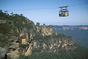
The Three Sisters and scenic skyway, Katoomba, the Blue Mountains, UNESCO World Heritage Site, New South Wales (N.S.W.), Australia, Pacific
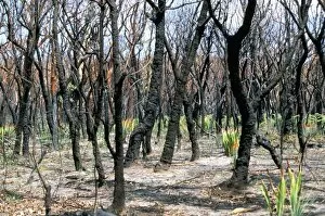
Burnt gum trees and new growth after severe bush fires in Royal National Park, south of Sydney, New South Wales, Australia, Pacific
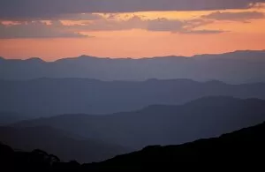
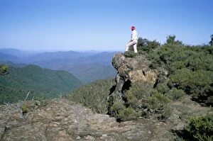
Landscape view, twilight glow and mountain ridges of High Country from Mount Feathertop, Alpine National Park, High Country, Victoria, Australia, Pacific
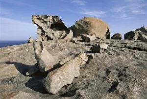
Remarkable Rocks, Flinders Chase National Park, Kangaroo Island, South Australia, Australia, Pacific
New England National Park, UNESCO World Heritage Site, National Forest, New South Wales, Australia, Pacific
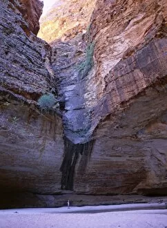
Rocky amphitheatre with pool, at head of Cathedral Gorge, Purnululu National Park, UNESCO World Heritage site, Bungle Bungle, Kimberley, Western Australia, Australia, Pacific
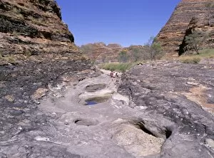
Tourists cross flood scoured rocks, past typical formations, Purnululu National Park, UNESCO World Heritage Site, Bungle Bungle, Kimberley, Western Australia, Australia, Pacific
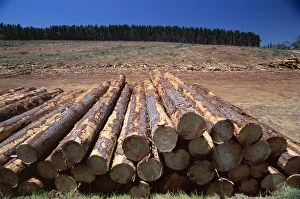
Logged section of a fir tree plantation by the Princes Highway, northwest of Mount Gambier, South Australia, Australia, Pacific
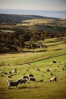
Sheep on pastureland near Cape Jervis, Fleurieu Peninsula, South Australia, Australia, Pacific
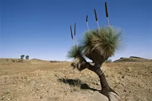
Yakka plant, Flinders Range, South Australia, Australia, Pacific
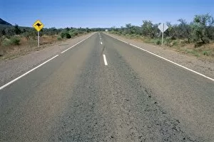
Kangaroo sign and empty road, Flinders Range, South Australia, Australia, Pacific
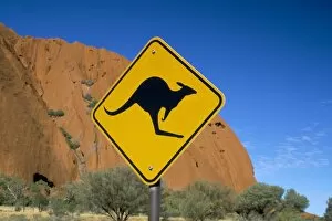
Kangaroo road sign at Uluru (Ayers Rock), Uluru-Kata Tjuta National Park, Northern Territory, Australia, Pacific
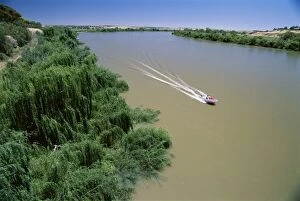
The Murray River at Murray Bridge, the states largest river town, south east of Adelaide, South Australia, Australia, Pacific
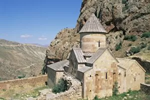
St. John the Baptist, Noravank monastery, Armenia, Central Asia, Asia
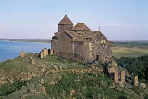
Ayrivank, Lake Sevan, Armenia, Central Asia, Asia
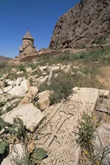
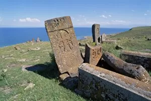
Abandoned graves, Armenia, Central Asia, Asia
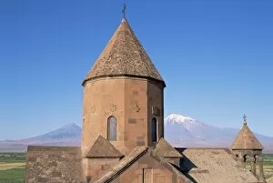
Khorvirap monastery, Mount Ararat region, Armenia, Central Asia, Asia
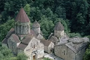
Agarcine (Agartsin), Armenia, Central Asia, Asia
Christian tombs, Salohiyakk, Lake Sevan, Armenia, Central Asia, Asia
Maras, Peninsula Valdes, Argentina, South America
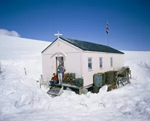
British Antarctic Survey summer only base Damoy, on Wiencke Island, Antarctic Pensinula, Antarctica, Polar Regions
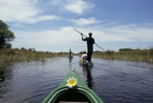
Tourists in dug out canoe (mokoro), Okavango Delta, Botswana, Africa
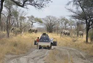
Tourist standing by car watching elephants cross road, Chobe National Park, Botswana, Africa
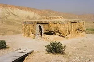
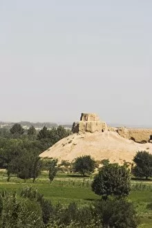
Buddhist stupa carved out of rock at Takht-I-Rustam (Rustams throne) an early burial mound that contained relics of the Buddha
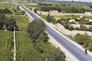
Women ride donkeys along side of road between Maimana and Mazar-I-Sharif, Afghanistan, Asia
View of man riding horse along road, taken from army checkpoint at remains of a Buddhist stupa, Top-I-Rustam, Balkh (Mother of Cities), Afghanistan, Asia
Remains of Buddhist monastery, Balkh (Mother of Cities), Balkh province, Afghanistan, Asia
Farmhouse on the southern route between Kabul and Bamiyan, Afghanistan, Asia
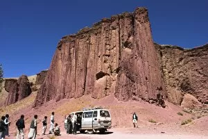
Tourist and locals at the Magenta cliffs near Shahr-e-Zohak (Red City), between Kabul and Bamiyan (the southern route), Bamiyan province, Afghanistan, Asia
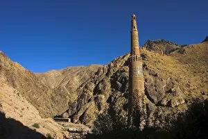
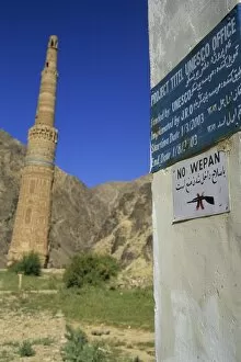
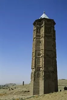
Minaret of Jam, UNESCO World Heritage Site, dating from the 12th century, with Quasr Zarafshan in background, Ghor Province, Afghanistan, Asia
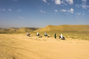
Aimaq nomad camps, near village of Jam, Ghor (Ghowr province), Afghanistan, Asia
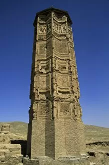
The 65 metre tall Minaret of Jam, built by Sultan Ghiyat Ud-Din Muhammad ben San, in around 1190, with Kufic script and verses of the Koran on the exterior and a double-spiral staircase inside
The minaret of Sultan Mas ud III, one of two minarets built by Sultan Mas ud III and Bahram Shah with square Kufic and Noshki script, that served as models for the minaret of Jam
The minaret of Bahram Shah, one of two minarets built by Sultan Mas ud III and Bahram Shah with square Kufic and Noshki script, that served as models for the minaret of Jam
School in valley near Hari Rud river, between Jam and Chist-I-Sharif, Ghor (Ghowr) province, Afghanistan, Asia
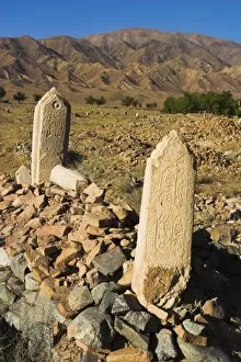
Tombs near Ghorid (12th century) ruins believed to be a mausoleum or madrassa, Chist-I-Sharif, Ghor (Ghur) (Ghowr) province, Afghanistan, Asia
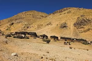
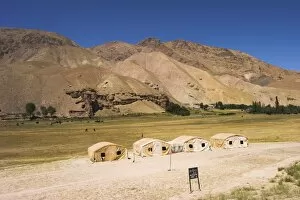
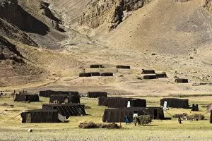
Summer yurts in camp of Aimaq semi-nomads, between Chakhcharan and Jam, Pal-Kotal-i-Guk, Afghanistan, Asia
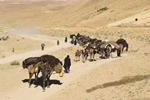
Kuchie nomad camel train, between Chakhcharan and Jam, Afghanistan, Asia
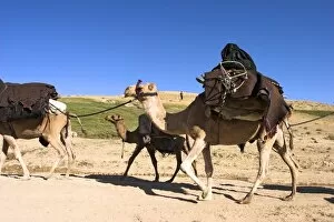
Woman sitting on top of camel, Kuchie nomad camel train, between Chakhcharan and Jam, Afghanistan, Asia
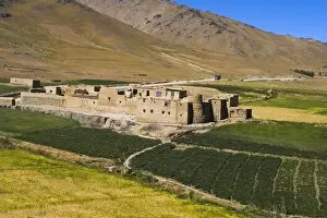
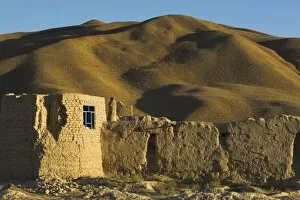
Caravanserai, Daulitiar, between Yakawlang and Chakhcharan, Afghanistan, Asia
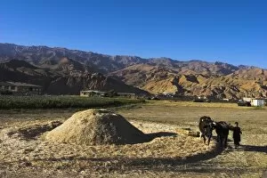
Boy threshing with oxen, Bamiyan Province, Afghanistan, Asia
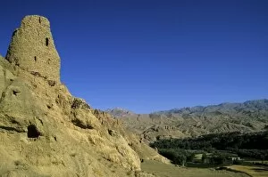
Ruined citadel of Shahr-e-Gholgola (City of the Screaming) (City of Noise), destroyed by Genghis Khan in 1221 AD, Bamiyan, Afghanistan, Asia