mail_outline sales@mediastorehouse.com
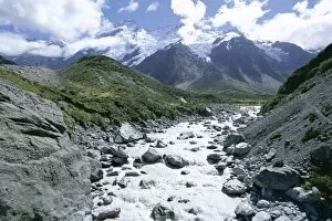
The Hooker River flowing from the Hooker Glacier, hanging glaciers below Mount Sefton beyond, Mount Cook National Park, Southern Alps, Canterbury, South Island, New Zealand, Pacific
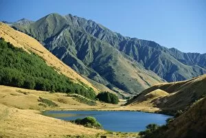
Moke Lake near Queenstown in scenic area in west Otago, South Island, New Zealand, Pacific
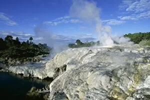
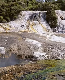
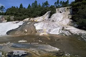
Mineral terraces around geysers, Whakarewarewa thermal area, Rotorua, South Auckland, North Island, New Zealand, Pacific
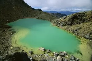
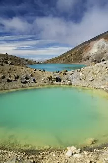
One of the Emerald Lakes, explosion craters filled with mineral-tinted water, on Mount Tongariro, Tongariro National Park, UNESCO World Heritage Site, central plateau, North Island, New Zealand
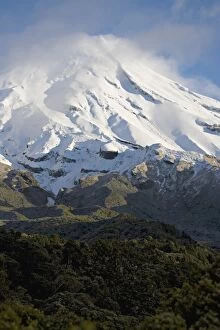
The dormant volcano Mount Egmont or Taranaki, Egmont National Park, Taranaki, North Island, New Zealand, Pacific
Papakorito falls at Aniwaniwa, Lake Waikaremoana, North Island, New Zealand, Pacific
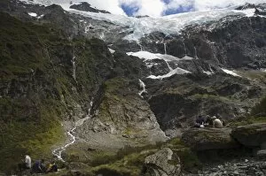
Hikers watch water cascading off Rob Roy Glacier, Mount Aspiring National Park, Otago, South Island, New Zealand, Pacific
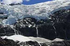
Water cascading off Rob Roy Glacier, Mount Aspiring National Park, Otago, South Island, New Zealand, Pacific
Hikers near Emerald Lakes on the Tongariro Crossing, Tongariro National Park, UNESCO World Heritage Site, the oldest national park in New Zealand, Taupo Volcanic Zone, North Island, New Zealand
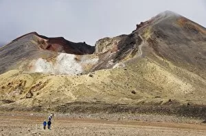
Hikers at Red Crater on the Tongariro Crossing, Tongariro National Park, the oldest national park in the country, UNESCO World Heritage Site, Taupo Volcanic Zone, North Island, New Zealand, Pacific
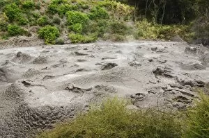
Mud Pool, Te Puia Wakarewarewa Geothermal Village, Rotorua, Taupo Volcanic Zone, North Island, New Zealand, Pacific
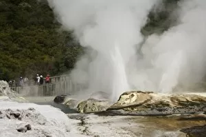
Pohutu Geyser at Te Puia Wakarewarewa Geothermal Village, Rotorua, Taupo Volcanic Zone, North Island, New Zealand, Pacific
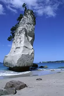
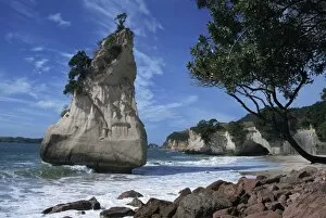
Cathedral Cove, Coromandel Peninsula, South Auckland, North Island, New Zealand, Pacific
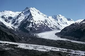
The Tasman Glacier and the Minaret Mountain, Westlands National Park, Canterbury, South Island, New Zealand, Pacific
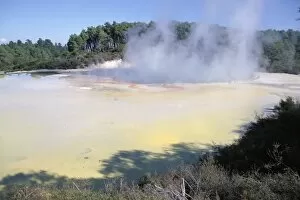
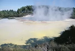
Champagne Pools steaming, Waiotapu thermal reserves, Rotorua, South Auckland, North Island, New Zealand, Pacific
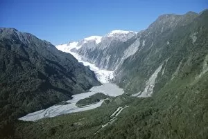
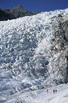
Fox Glacier, Westland, west coast, South Island, New Zealand, Pacific
Views of the top of Fox Glacier, West Coast, South Island, New Zealand, Pacific
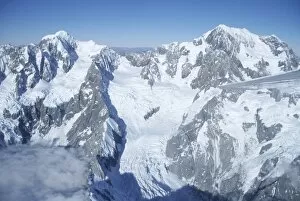
Aerial view of peak of Mount Cook, Mount Cook National Park, Southern Alps, Canterbury, South Island, New Zealand, Pacific
Champagne lakes, Thermal reserve, Waiotapu, South Auckland, North Island, New Zealand, Pacific
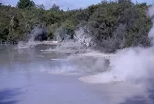
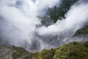
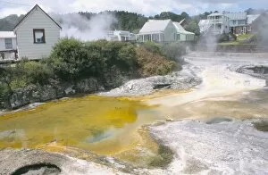
Steam and bubbling mud pools in thermal area, Rotorua, South Auckland, North Island, New Zealand, Pacific
Te Horo rock, Cathedral Cove, Coromandel Peninsula, North Island, New Zealand, Pacific
Thermal activity, Karapiti area, Taupo, South Auckland, North Island, New Zealand, Pacific
Cascade terrace, Hochsteller Cauldron, the Hidden Valley, Orakei Korako Geyserland, thermal area in South Auckland, North Island, New Zealand, Pacific
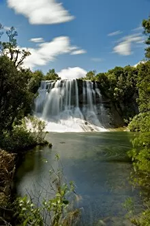
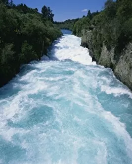
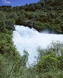
Hukanui, the Huka Falls on the Waikato River, 10m, 62, 000 gallons per second at peak times, in the North Island of New Zealand, Pacific
The Huka Falls, known as Hukanui (great body of spray) in Maori, 10m high, 62000 gallons of water per second at peak times, Waikato River, South Auckland, North Island, New Zealand, Pacific
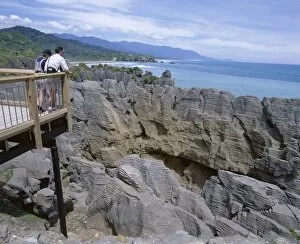
Tourists on viewing platform, Punakaiki, Pancake Rocks and blowholes, Paparoa National Park, Westland, South Island, New Zealand, Pacific
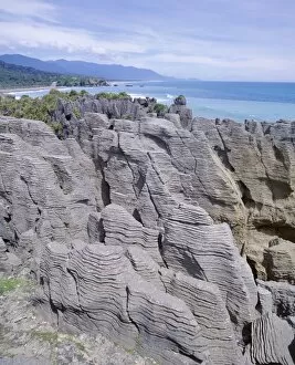
Pancake Rocks, Punakaiki, Paparoa National Park, Westland, New Zealand, Pacific
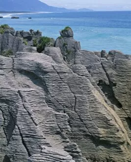
Eroded stratified limestone columns, Dolomite Point, Punakaiki Pancake rocks and blowholes, Paparoa National Park, Westland, South Island, New Zealand, Pacific
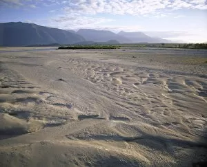
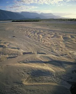
Flood plain with sand depressions, Hst River Valley, from road to Hst Pass, the start of the main divide, Hst, Westland, South Island, New Zealand, Pacific
Sand depressions in the flood plain of the Hst River valley at the start of the main divide, Hst, Westland, South Island, New Zealand, Pacific
Cascade Terrace at Orakei Korako Thermals in the North Island of New Zealand, Pacific
Whakarewarewa Thermal Park, Rotorua, North Island, New Zealand, Pacific
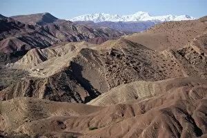
Mountains and village near Telouet, High Atlas mountains, Morocco, North Africa, Africa
Sand dune of the Erg Chebbi, Sahara Desert near Merzouga, Morocco, North Africa, Africa
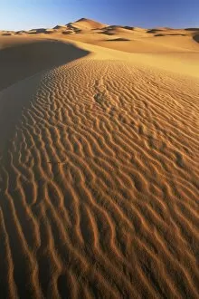
Sand dunes in Erg Chebbi sand sea, Sahara Desert, near Merzouga, Morocco, North Africa, Africa
Close-up of sand dunes in Erg Chebbi sand sea, Sahara Desert, near Merzouga, Morocco, North Africa, Africa
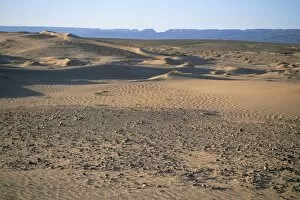
Anti Atlas mountains from the dunes at Erg Al Hatin, Draa Valley, Morocco, North Africa, Africa
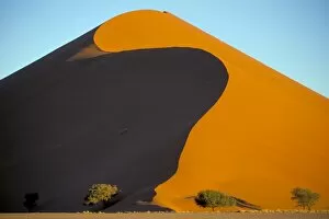
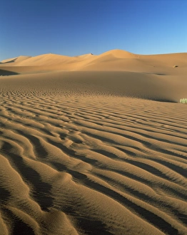
Red sand dunes, up to 300m, Sossusvlei, Namib-Naukluft Desert Park, Namibia, Africa
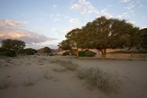
Hoanib, dry river bed, Namibia, Africa
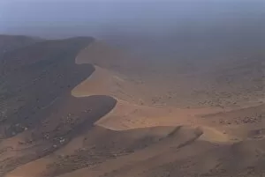
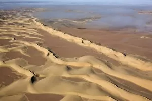
Aerial photo of sand dunes, Skeleton Coast Park, Namibia, Africa
Aerial photo, Skeleton Coast Park, Namibia, Africa
Sand dune, Sossusvlei dune field, Namib-Naukluft Park, Namib Desert, Namibia, Africa
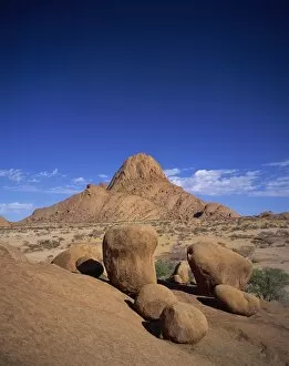
Rock formations at Spitzkoppe, between Windhoek and Swakopmund, Namibia, Africa
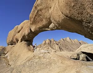
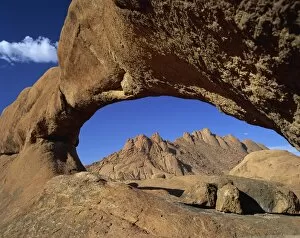
Natural arch, Spitzkoppe, 1728m, between Windhoek and Shakapmund, Damaraland, Namibia, Africa
Spitzkoppe, 1728m, between Windhoek and Shakapmund, Damaraland, Namibia, Africa
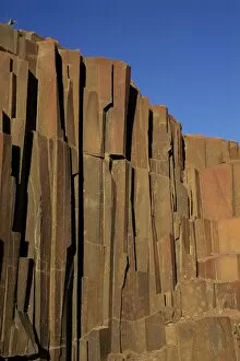
Organ pipes formation (dolerite columns), Twyfelfontein, Namibia, Africa
Sand dunes and dune sea, Sesriem, Namib Naukluft Park, Namibia, Africa
Sand dune and tree near Sesriem, Namib Naukluft park, Namibia, Africa