mail_outline sales@mediastorehouse.com
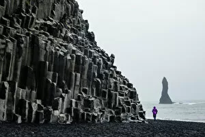
Basalt columns at the beach, Vik i Myrdal, Iceland, Polar Regions
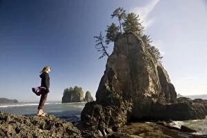
Young woman enjoying the coast, Second Beach, Olympic National Park, UNESCO World Heritage Site, Washington State, United States of America, North America
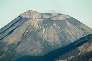
Smoking 700m wide crater of Volcan Telica in the North West volcano chain, one of the countrys most active volcanoes, Leon, Nicaragua, Central America
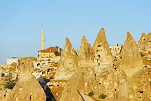
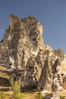
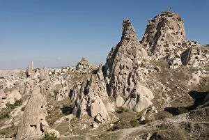
Rock-cut topography at Uchisar, UNESCO World Heritage Site, Cappadocia, Anatolia, Turkey, Asia Minor, Eurasia
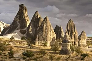
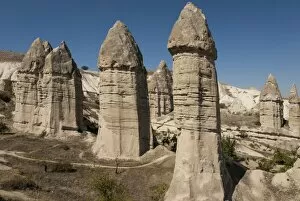
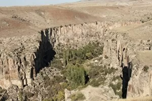
Unusual rock formations in the Rose Valley, Cappadocia, Anatolia, Turkey, Asia Minor, Eurasia
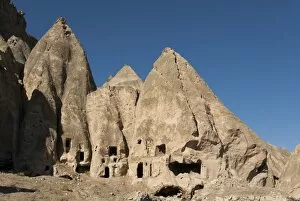
The town of Orchisar, showing the old tunneled houses dug into the volcanic rock, Cappadocia, Anatolia, Turkey, Asia Minor, Eurasia
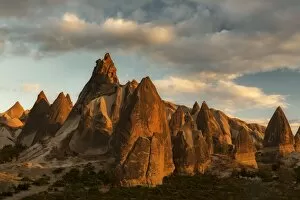
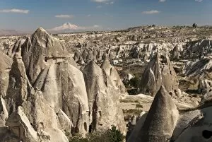
Volcanic desert landscape and its fabulous geographical structures caught in evening light, Goreme, Cappadocia, Anatolia, Turkey, Asia Minor, Eurasia
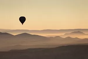
Single hot air balloon over a misty dawn sky, Cappadocia, Anatolia, Turkey, Asia Minor, Eurasia
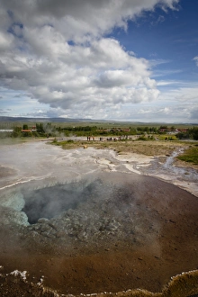
A geothermal hotspring pool with dissolved minerals, Geysir, Golden Circle, Iceland, Polar Regions
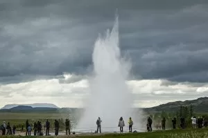
Strokkur geyser, Geysir, Golden Circle, Iceland, Polar Regions
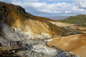
Geothermal fields at Krysuvik, Reykjanes Peninsula, Iceland, Polar Regions
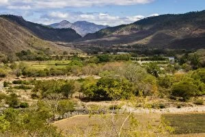
View of the Guayabo Valley where the Coco River opens out below the famous Somoto Canyon, Somoto, Madriz, Nicaragua, Central America
Summit of active Volcan San Cristobal, 1745m, in the North West volcano chain, the countrys highest volcano, Chinandega, Nicaragua, Central America
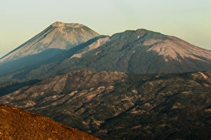
Summit of 1745m active Volcan San Cristobal on left, the countrys highest volcano, and Volcan Casita on the right, Chinandega, Nicaragua, Central America
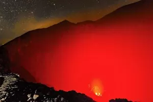
Glowing active 700m wide volcanic crater of Volcan Telica with lava vents far below, in the North West volcanic chain, Leon, Nicaragua, Central America
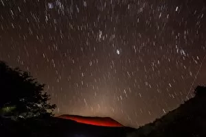
Glowing active volcanic crater of Volcan Telica at night with star trails and shooting star (meteor) on right, Leon, Nicaragua, Central America
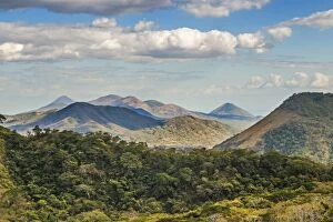
The North West volcanic chain, distant on left Momotombo, centre Rota and Las Pilas complex, on right Momotombito and Santa Clara, Leon, Nicaragua, Central America
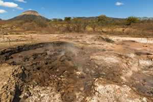
Mud pots, fumaroles and dormant Volcan Santa Clara at the San Jacinto volcanic thermal area north of Leon, Leon, Nicaragua, Central America
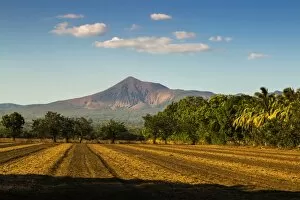
Fields north of Leon and Volcan Telica, one of the countrys most active volcanoes, in the North West volcanic chain, Leon, Nicaragua, Central America
Selime, Ihlara, western Cappadocia, Anatolia, Turkey, Asia Minor, Eurasia
Uchisar, Cappadocia, Anatolia, Turkey, Asia Minor, Eurasia
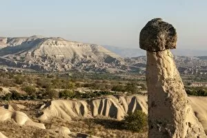
Natural pinnacles in volcanic ash, Zemi Valley, Goreme, UNESCO World Heritage Site, Cappadocia, Anatolia, Turkey, Asia Minor, Eurasia
Goreme, UNESCO World Heritage Site, Cappadocia, Anatolia, Turkey, Asia Minor, Eurasia
Pinnacles of volcanic ash, Urgup, UNESCO World Heritage Site, Cappadocia, Anatolia, Turkey, Asia Minor, Eurasia
Ihlara Canyon, western Cappadocia, Anatolia, Turkey, Asia Minor, Eurasia
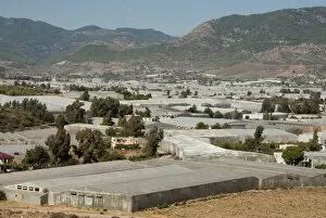
Agriculture under plastic, Anamur Plain, Taurus coast, Southern Turkey, Anatolia, Turkey, Asia Minor, Eurasia
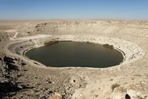
Meyil Obruk, 640m wide sinkhole lake, Esentepe, Obruk Plateau, Karapinar, Konya Basin, Anatolia, Turkey, Asia Minor, Eurasia
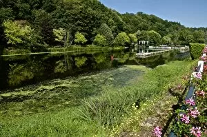
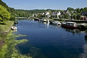
River Blavet and locks at Saint Nicolas des Eaux, canal from Nantes to Brest, Morbihan, Brittany, France, Europe
Boats on River Blavet and locks at Saint Nicolas des Eaux, canal from Nantes to Brest, Morbihan, Brittany, France, Europe
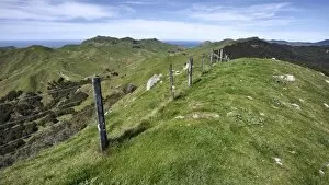
Farmland on the Tora Coastal Walkway, Wairarapa, North Island, New Zealand, Pacific
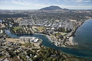
Aerial of Taupo Town and Mount Tauhara, Waikato River and Lake Taupo, North Island, New Zealand, Pacific
River, Abisko National Park Helsinki, Finland, Scandinavia, Europe
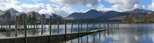
Lake Derwentwater, Catbells, Brandlehow, Causey Pike and Grisdale Pike, from the boat landings at Keswick, North Lakeland, Lake District National Park, Keswick, Cumbria, England, United Kingdom
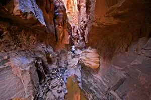
Tourist in Khazali Canyon, Wadi Rum, Jordan, Middle East
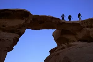
Jebel Umm Fruth Rock Bridge, Wadi Rum, Jordan, Middle East
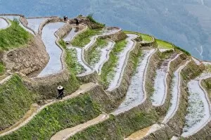
Dragon Spine Rice Terraces, Longsheng, Guangxi, China, Asia
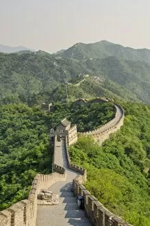
The original Mutianyu section of the Great Wall, UNESCO World Heritage Site, Beijing, China, Asia
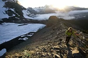
Woman hiking near Mount Olympus and Blue Glacier, Olympic National Park, UNESCO World Heritage Site, Washington State, United States of America, North America
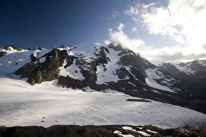
Mount Olympus and Blue Glacier, Olympic National Park, UNESCO World Heritage Site, Washington State, United States of America, North America
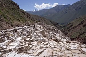
Salineras salt mine, Peru, South America
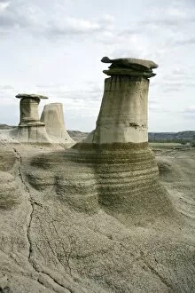
Hoodoos, limestone features, Badlands, Drumheller area, Alberta, Canada, North America
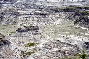
Dinosaur Valley, Drumheller, Alberta, Canada, North America