mail_outline sales@mediastorehouse.com
1,010 items
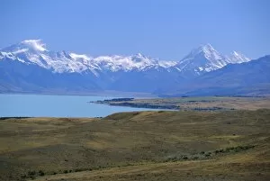
Looking north along Lake Pukaki towards the Southern Alps, with Mt Sefton, left, and Mt Cook, right; (glacial sediment causes the blue of many NZ lakes), Canterbury, South Island, New Zealand
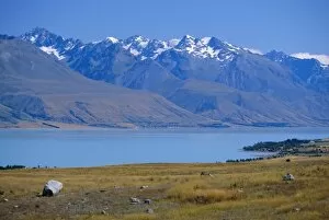
Lake Pukaki, Southern Alps, Canterbury, South Island, New Zealand, Australasia
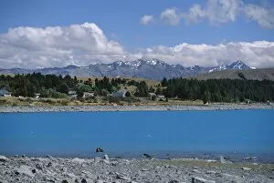
Glacial sediment causes blue colour in Lake Tekapo, mountains of the Southern Alps behind, Canterbury, South Island, New Zealand, Pacific
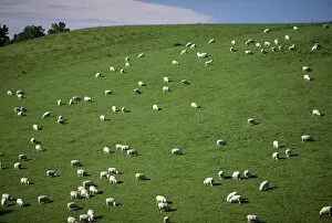
Sheep grazing on downs near Geraldine at the south western end of the Canterbury Plains, Canterbury, South Island, New Zealand, Pacific
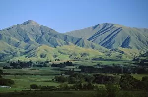
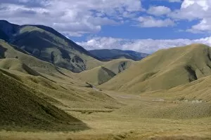
Downs and mountains north of Geraldine, southwestern end of the Canterbury Plains, Canterbury, South Island, New Zealand, Pacific
Barbie or barbeque at the Mayfield country show on the Canterbury Plains, Mayfield, Canterbury, South Island, New Zealand, Pacific
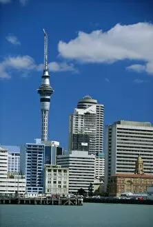
The waterfront, Sky City Tower and the city centre skyline, Auckland, North Island, New Zealand, Pacific
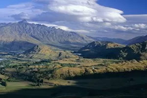
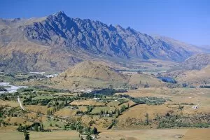
Looking south east from Coronet Peak towards the Shotover Valley and The Remarkables mountains, near Queenstown, west Otago, South Island, New Zealand, Pacific
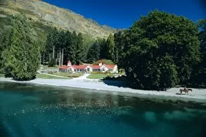
Walter Peak, a famous old sheep station founded in 1860, south shore of Lake Wakatipu, west Otago, South Island, New Zealand, Pacific
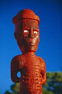
A carved figure, or poupou, in a Maori village at the Whakarewarewa thermal and cultural area of Rotorua, North Island, New Zealand
The Kawarau River, the outflow of Lake Wakatipu at Frankton, near Queenstown, with the Remarkables beyond, Otago, South Island, New Zealand, Pacific
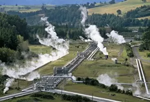
Aerial view of Wairakei thermal power area, North Island, New Zealand, Pacific
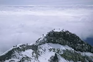
Hikers on Dome Ridge near the summit of 2797m Mount Ruapehu, highest and most active of the volcanoes in the National Park, Tongariro National Park, UNESCO World Heritage Site, central plateau
Lindis Pass, the point where Highway 8 crosses from Waitaki District into the Lindis River Valley, north Otago, South Island, New Zealand, Pacific
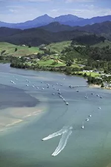
Aerial view of Tairua Harbour, east coast, Coromandel Peninsula, South Auckland, North Island, New Zealand, Pacific
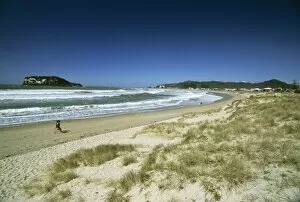
Beach on the east coast of Coromandel Peninsula, South Auckland, North Island, New Zealand, Pacific
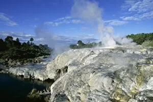
Mineral terraces around geysers, Whakarewarewa thermal area, Rotorua, South Auckland, North Island, New Zealand, Pacific
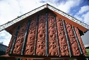
Intricately carved storehouse in replica village at the Maori Arts and Crafts Institute, Whakarewarewa thermal and cultural area, Rotorua, North Island, New Zealand, Pacific
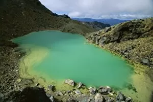
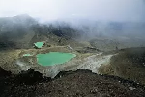
One of the Emerald Lakes, explosion craters filled with mineral-tinted water, on Mount Tongariro, Tongariro National Park, UNESCO World Heritage Site, central plateau, North Island, New Zealand
Emerald Lakes, explosion craters filled with mineral-tinted water, on Mount Tongariro, Tongariro National Park, UNESCO World Heritage Site, central plateau, North Island, New Zealand, Pacific
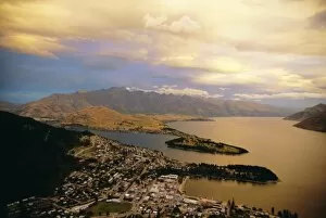
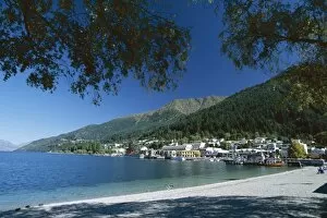
View from Skyline Chalet at top of the gondola, Queenstown, Lake Wakatipu and The Remarkables, west Otago, South Island, New Zealand, Pacific
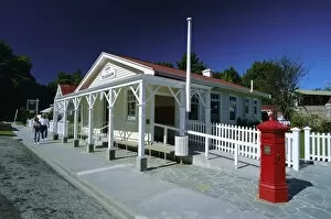
Post office and red post box in Arrowtown, a picturesque restored gold mining town, north east of Queenstown, west Otago, South Island, New Zealand, Pacific
View south east from Coronet Peak to the Shotover Valley and The Remarkables mountains, near Queenstown, western Otago, South Island, New Zealand, Pacific
The beach, Queenstown, Lake Wakatipu, Otago, South Island, New Zealand, Pacific
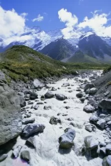
The Hooker River flowing from the Hooker Glacier, with the hanging glaciers below Mount Sefton in the Southern Alps in the background, Mount Cook National Park, Canterbury, South Island, New Zealand
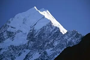
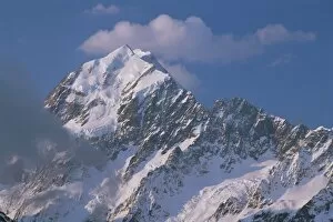
First light on the east face of 3755m Mount Cook, highest mountain in Australasia, Mount Cook National Park, Southern Alps, Canterbury, South Island, New Zealand, Pacific
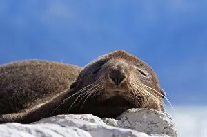
New Zealand fur seal (Arctocephalus fosteri), Kaikoura, South Island, New Zealand, Pacific
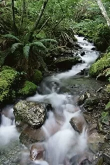
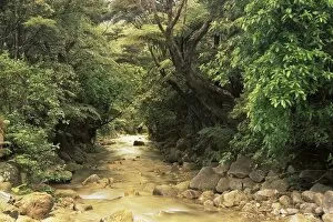
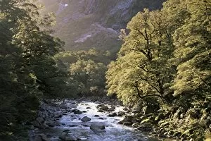
Stream through rainforest, Lewis Pass, South Island, New Zealand, Pacific
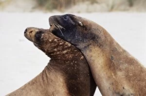
Hookers sea lions (Neophoca hooker), Cannibal Bay, Catlins Coast, Otago, South Island, New Zealand, Pacific
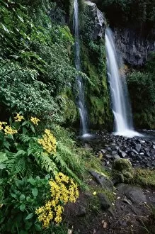
Dawson Falls, Egmont National Park, Taranaki, North Island, New Zealand, Pacific
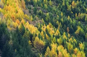
Larches, Waitiri, Central Otago, South Island, New Zealand, Pacific
Mountains stream, Coromandel Peinsula, North Island, New Zealand, Pacific
Mares Leg Cove, Coromandel Peninsula, North Island, New Zealand, Pacific
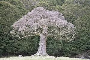
Old beech tree, Canaan Downs, South Island, New Zealand, Pacific
Beech forest, Mount Arthur-Kahurangi National Park, South Island, New Zealand, Pacific
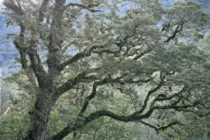
Beech tree, New Zealand, Pacific
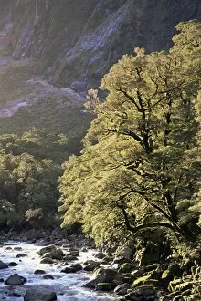
Hollyford River and beech trees, South Island, New Zealand, Pacific
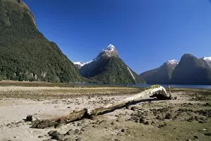
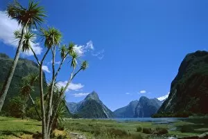
Milford Sound and Mitre Peak, South Island, New Zealand, Pacific
Mount Cook, Southern Alps, South Island, New Zealand, Pacific
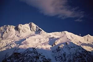
Mount Sefton, Mount Cook National Park, Hooker Valley, Southern Alps, South Island, New Zealand, Pacific
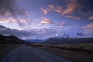
Two Thumbs Range, Rangitata Valley, South Island, New Zealand, Pacific
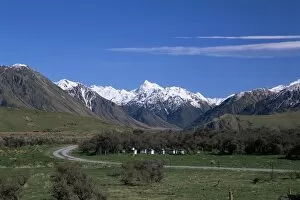
Country road, Rakaia Gorge, South Island, New Zealand, Pacific
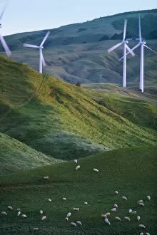
Te Apiti Wind Farm, Palmerston North, Manawatu, North Island, New Zealand, Pacific
Winter view of fence, shadow and skiers with mountains beyond at Mount Hutt, South Island, New Zealand, Pacific
Mitre Peak, Milford Sound, Otago, South Island, New Zealand, Pacific
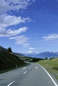
Road to Mount Cook, Mount Cook National Park, South Island, New Zealand, Pacific