mail_outline sales@mediastorehouse.com
394 items
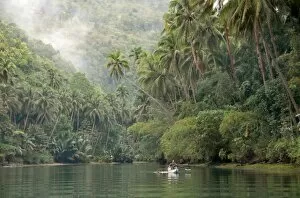
Loboc River, Bohol, Philippines, Southeast Asia, Asia
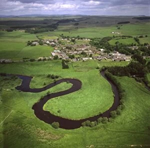
Aerial image of Otterburn, on the banks of the River Rede, Northumberland, England, United Kingdom, Europe
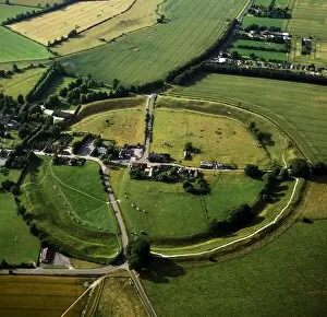
Aerial image of Avebury, Neolithic Monument, site of a large henge and several stone circles, UNESCO World Heritage Site, Wiltshire, England, United Kingdom, Europe
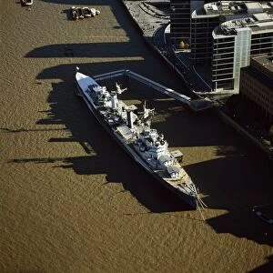
Aerial image of HMS Belfast, a Royal Navy Town-class cruiser, on the River Thames, London, England, United Kingdom, Europe
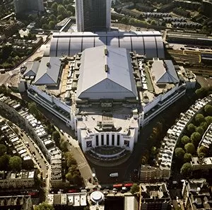
Aerial image of the Earls Court Exhibition Centre, Warwick Road, West London, London, England, United Kingdom, Europe
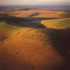
Aerial image of Mount Caburn with the remains of an Iron Age hill fort, east of Lewes, East Sussex, England, United Kingdom, Europe
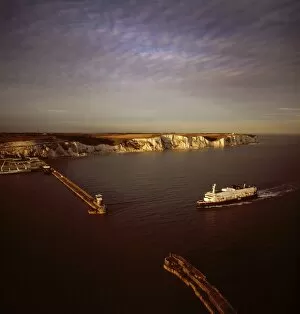
Aerial image of Dover Harbour (Port of Dover), with ferry arriving, Kent, England, United Kingdom, Europe
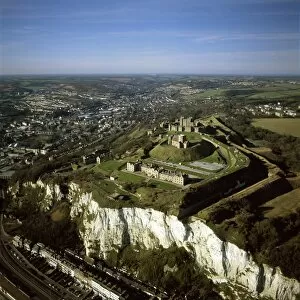
Aerial image of Dover Castle over the white Cliff of Dover, Kent, England, United Kingdom, Europe
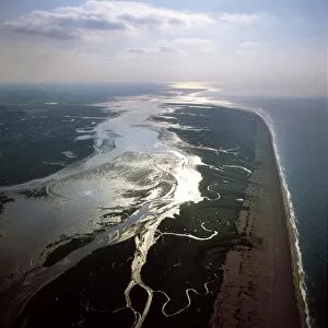
Aerial image of Blakeney Point, Norfolk, England, United Kingdom, Europe
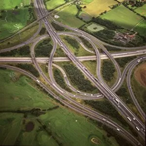
Aerial image of M25 and M11 Motorway Junction, Essex, England, United Kingdom, Europe
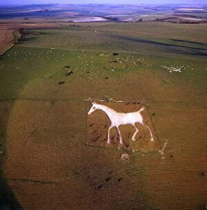
Aerial view of Alton Barnes White Horse, Alton Barnes, Wiltshire, England, United Kingdom, Europe
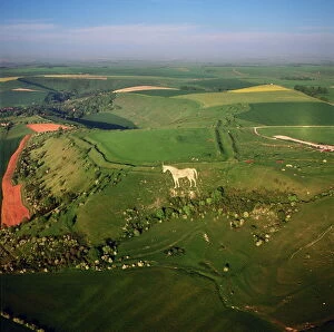
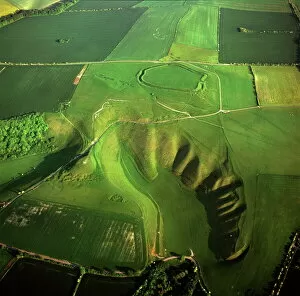
Aerial view of the Westbury White Horse and the Iron Age Bratton Camp Hill Fort, Wiltshire, England, United Kingdom, Europe
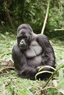
Silverback male Mountain Gorilla (Gorilla g. beringei), Virunga Volcanoes, Rwanda, Africa
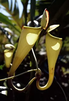
Madagascar pitcher plant (Nepenthes madagascariensis), a carnivorous plant that produces impressive pitchers that catch the insect prey, Madagascar, Africa
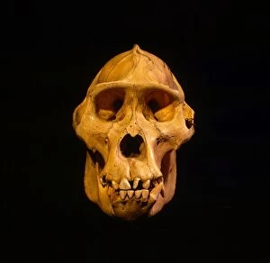
Skull of Mountain Gorilla (Gorilla gorilla beringei), holotype 1902, Museum fur Natuurkunde, Berlin, discovered by Captain Robert von Beringe, Virunga Volcanoes, Rwanda, Africa
Aerial image of Polpeor Cove, Lizard Point, most southerly tip of Great Britain, Cornwall, England, United Kingdom, Europe
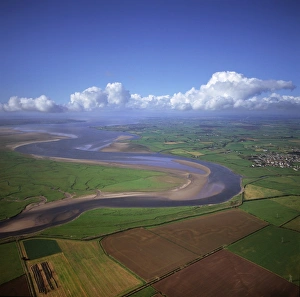
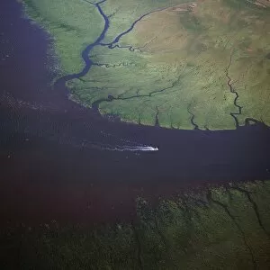
Aerial image of the River Esk flowing into Solway Firth, near Gretna Green, border between Cumbria in England and Dumfries and Galloway in Scotland, United Kingdom, Europe
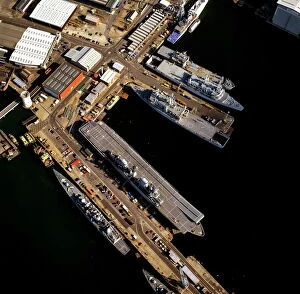
Aerial image of Portsmouths Dockyard and Naval Base, Portsmouth Harbour, Hampshire, England, United Kingdom, Europe
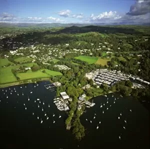
Aerial image of Bowness-on-Windermere, Lake Windermere, Lake District National Park, Cumbria, England, United Kingdom, Europe
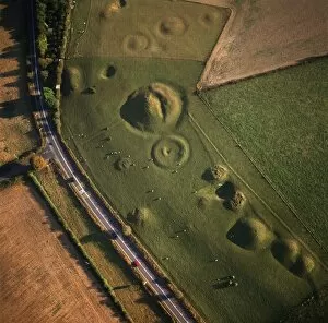
Aerial image of Winterbourne Poor Lot Round Barrows, Winterbourne Abbas, Dorset, England, United Kingdom, Europe
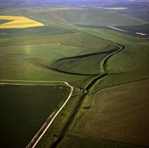
Aerial image of Wansdyke (from Wodens Dyke), an early medieval series of defensive linear earthworks, Tan Hill, Wiltshire, England, United Kingdom, Europe
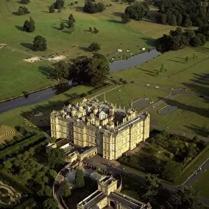
Aerial image of Longleat, an English country house, Horningsham, near Warminster, Wiltshire, England, United Kingdom, Europe
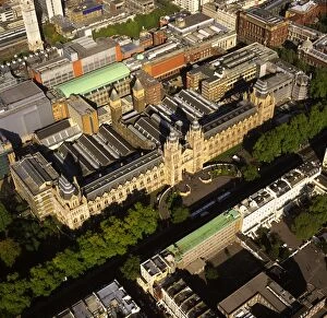
Aerial image of the Natural History Museum, Albertopolis, South Kensington, London, England, United Kingdom, Europe
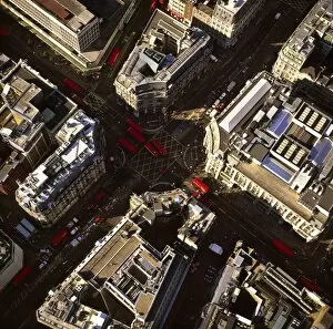
Aerial image of Oxford Circus, a busy intersection of Regent Street and Oxford Street, in the City of Westminster, London, England, United Kingdom, Europe
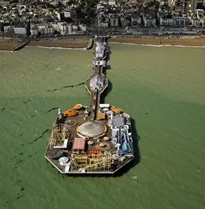
Aerial image of Brighton Pier (Palace Pier), Brighton, Sussex, England, United Kingdom, Europe
Aerial image of the Uffington White Horse with Uffington Castle hill fort, Berkshire Downs, Vale of White Horse, Oxfordshire, England, United Kingdom, Europe
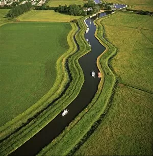
Aerial view of the Norfolk Broads at Ludham Bridge, Norfolk, England, United Kingdom, Europe
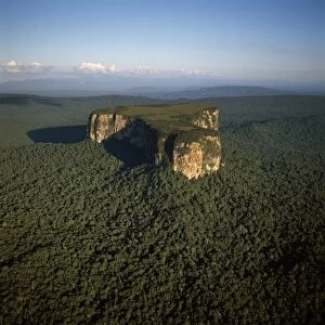
Aerial image of Ayangaik mountain, Upper Mazaruni District, Guyana, South America
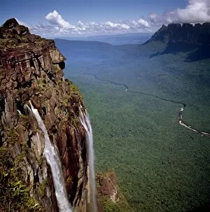
Angel Falls and Mount Auyantepui (Auyantepuy) (Devils Mountain), looking out to Churun Gorge and Churun River, Tepuis, Venezuela, South America
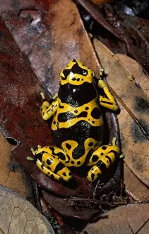
Dendrobatid poison dart Frog (Dendrobates leucomelas), Venezuela, South America
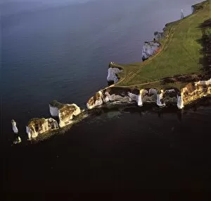
Aerial image of Old Harry Rocks, chalk stacks located directly east of Studland, north of Swanage, Dorset, England, United Kingdom, Europe
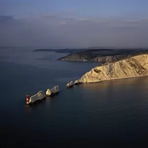
Aerial image of The Needles, a row of three chalk stacks, and Lighthouse, off the western extremity of the Isle of Wight, Alum Bay, Isle of Wight, England, United Kingdom, Europe
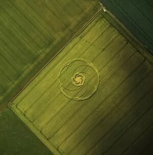
Aerial image of crop circle, Wiltshire, England, United Kingdom, Europe
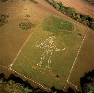
Aerial image of the Cerne Abbas Giant, Cerne Abbas, Dorset, England, United Kingdom, Europe
Aerial view of Blakeney Point, Norfolk, England, United Kingdom, Europe
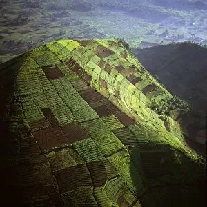
Aerial view of intensive agriculture on Virunga foothills, Democratic Republic of Congo, Africa
Ring-tailed Lemur (Lemur catta) sunbathing on ground, Berenty, Southern Madagascar, Africa
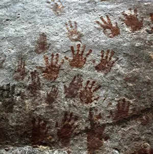
Karowrieng rock paintings, Chi-Chi Gorge, Upper Mazaruni District, Guyana, South America
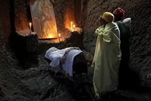
Women praying in Bet Medhane Alem church in Lalibela, Wollo, Ethiopia, Africa
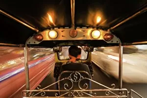
Tuk-tuk (auto rickshaw) in motion at night, Bangkok, Thailand, Southeast Asia, Asia
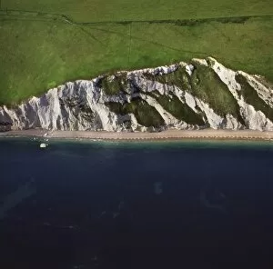
Aerial image of Chalk Cliff just east of White Nothe, on the Jurassic Coast, UNESCO World Heritage Site, Dorset, England, United Kingdom, Europe
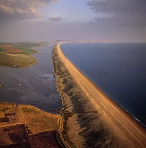
Aerial image of Chesil Beach (Chesil Bank), 29 km long shingle beach, a tombolo connecting mainland to the Isle of Portland, Jurassic Coast, UNESCO World Heritage Site, Dorset, England
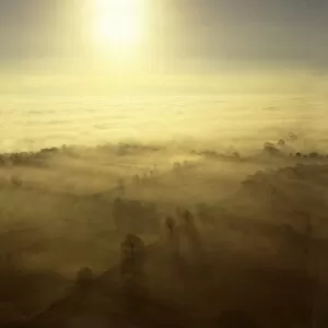
Aerial image of fog over the Somerset Levels, near Glastonbury, Somerset, England, United Kingdom, Europe
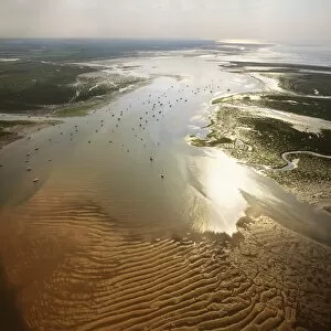
Aerial view of the mouth of Great Ouse River entering The Wash, Kings Lynn, Norfolk, England, United Kingdom, Europe
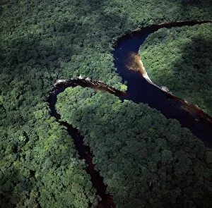
Aerial image of the confluence of Paikwa River with Kako River, Upper Mazaruni District, Guyana, South America
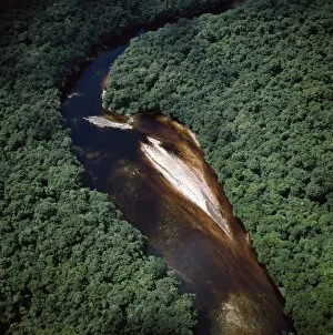
Aerial image of river bend and sandbars in the Paikwa River, Upper Mazaruni District, Guyana, South America
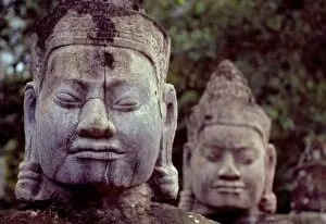
Carved stone statues aligned at South Gate to Angkor Thom, Angkor, UNESCO World Heritage Site, Cambodia, Southeast Asia, Asia