mail_outline sales@mediastorehouse.com
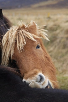
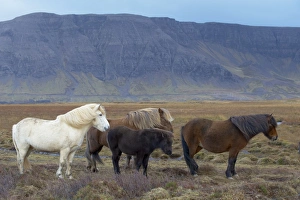
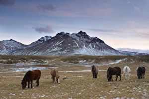
Icelandic horses near Neskaupstadur in Nordjfordur fjord, one of the East Fjords, Iceland, Polar Regions
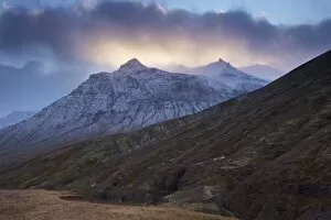
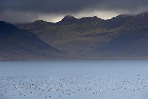
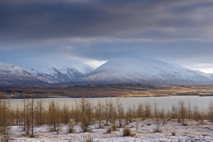
Sunset on snowy mountains, Skumhottur, 1229m, in Reydarfjordur fjord, East Fjords, Iceland, Polar Regions
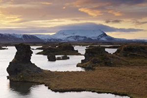
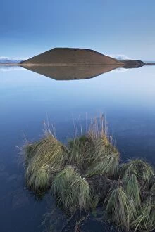
Rock formations (lava) at sunset, at Kalfastrond, east shore of Lake Myvatn, Myvatn area, Iceland, Polar Regions
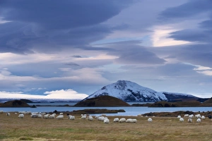
Icelandic sheep on east shore of Lake Myvatn, pseudo-craters and Mount Vindbelgjarfjall (Vindbelgur), 529m, in the distance, Myvatn area, Iceland, Polar Regions
Shores of Lake Myvatn at dusk, fine pseudo-crater in the distance, near Skutustadir, Myvatn, northern area, Iceland, Polar Regions
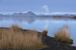
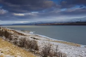
Shores of Lake Myvatn, Mount Hlidarfjall, 771m, visible in the distance, near Skutustadir, northern area, Iceland, Polar Regions
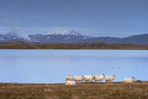
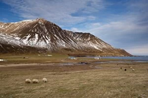
Icelandic sheep on the shores of Lake Myvatn, Mount Hlidarfjall, 771m, visible in the distance, near Skutustadir, northern area, Iceland, Polar Regions
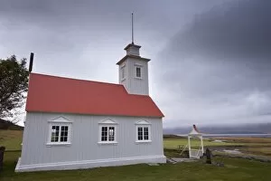
Laufas historic farmstead, the present church built in 1865, north of Akureyri, Iceland, Polar Regions
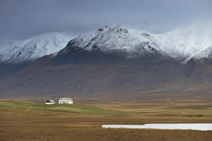
Laekjamdt farm, snow-covered Vididalsfjall mountain behind, near Blonduos, north coast, Iceland, Polar Regions
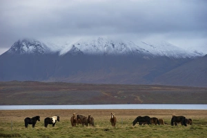
Icelandic horses in Vatsnes Peninsula, with snow-covered mountains in October, north coast of Iceland, Iceland, Polar Regions
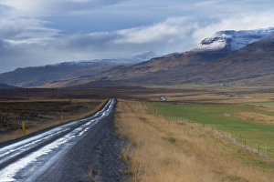
Road and landscape in Vatsnes Peninsula, with snow-covered mountains in October, north coast of Iceland, Iceland, Polar Regions
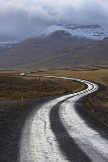
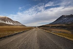
Road 711 in Vatsnes Peninsula, not far from Blonduos, in the north of Iceland, Iceland, Polar Regions
Icelandic horses near Hrisar (Hvammsfordur), West Iceland, Iceland, Polar Regions
Flocks of Eider ducks (Somateria mollissima) on sheltered waters of Kolgrafafjordur fjord near Grundarfjordur in autumn, Snaefellsnes Peninsula, Iceland, Polar Regions
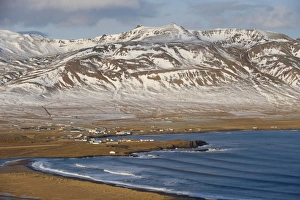
View of Grundarfjordur and Grundarfjordur Bay, Mount Kirkjufell, 463m, in the distance, Snaefellsnes Peninsula, Iceland, Polar Regions
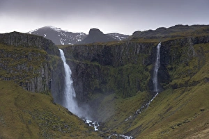
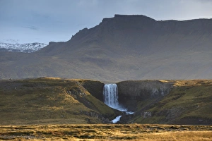
Grundarfoss waterfall near Grundarjordur, Snaefellsnes Peninsula, Iceland, Polar Regions
Waterfall in Snaefellsjokull National Park, Snaefellsjokull behind, covered in clouds, near Hellisandur, Snaefellsnes Peninsula, Iceland, Polar Regions
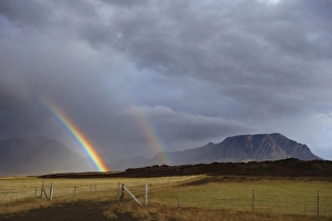
Rainbow over hills, Snaefellsnes Peninsula, West Iceland, Iceland, Polar Regions
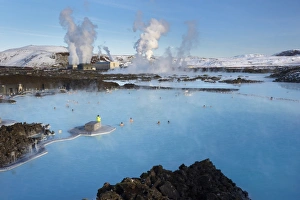
People relaxing in Blue Lagoon geothermal spa, Svartsengi Geothermal Power Station in the distance, Grindavik, Reykjanes Peninsula, Iceland, Polar Regions
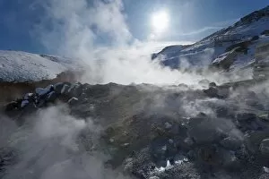
Geothermal activity of mudpots, hot springs and fumaroles, at Krisuvik (Krysuvik-Seltun), Reykjanes Peninsula, south-west Iceland, Iceland, Polar Regions
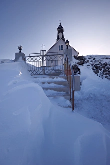
Strandakirkja wooden church in winter, said to be the richest in Iceland, because of donations of many seamen for centuries, Reykjanes Peninsula, between Thorlakshofn and Grindavik, Iceland
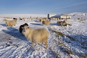
Icelandic sheep in winter, Reykjanes Peninsula near Krisuvik, Iceland, Polar Regions
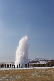
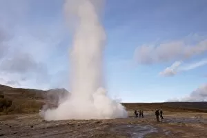
Tourists watching geyser erupting, Strokkur (the Churn) erupts every 5-10 minutes to heights of up to 20 meters (70ft), Geysir, Golden Circle, Iceland, Polar Regions
Strokkur (the Churn) erupts every 5-10 minutes to heights of up to 20 meters (70ft), Geysir, Golden Circle, Iceland, Polar Regions
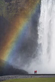
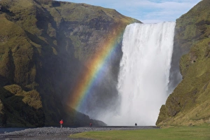
Tourists in red jacket at 62 m high Skogafoss waterfall, Skogar, South area, Iceland, Polar Regions
Tourist in red jacket at 62 m high Skogafoss waterfall, Skogar, South area, Iceland, Polar Regions
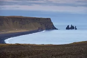
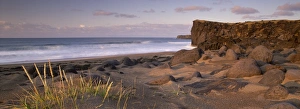
Black sand beach, rock formation and Reynisdrangar sea stacks in the distance, from Dyrholaey near Vik, Iceland, Polar Regions
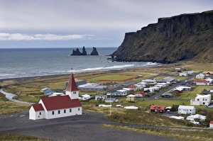
Church, village of Vik (Vik a Myrdal) and Reynisdrangar sea stacks in the distance, Iceland, Polar Regions
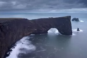
Dyrholaey natural arch, southernmost point in Iceland, at dusk, near Vik, Iceland, Polar Regions
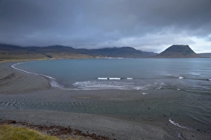
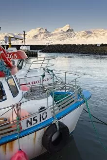
Fishing harbour at Hofn, near Bakkagerdi in Borgarfjordur Eystri fjord, Mount Dyrfjoll (Door mountain), 1136m, in background, East Fjords, Iceland, Polar Regions
Panoramic view of Seydisfjordur and surrounding mountains, East Fjords, Iceland, Polar Regions
Church at Narfeyri, view over Breidafjordur (Hvammsfjordur), West Iceland, Iceland, Polar Regions
Lava fields, Snaefellsnes Peninsula, Iceland, Polar Regions
Skardsvik, white-sand beach bordered by lava flows in the north of Snaefellsjokull National Park, Snaefellsnes Peninsula, Iceland, Polar Regions
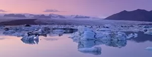
Jokulsarlon glacial lagoon, Breidamerkurjokull (Vatnajokull) glacier in the distance, Iceland, Polar Regions
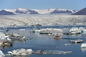
Tourist boat in Jokulsarlon glacial lagoon on a sunny morning, East Iceland, Iceland, Polar Regions
Mount Bulandstindur, 1069m, pyramid shaped stack of basaltic strata, in Berufjordur, East Fjords, Iceland, Polar Regions
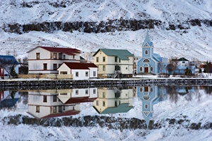
Traditional wooden church, built in 1922, at Seydisfjordur, a town founded in 1895 by a Norwegian fishing company, now main ferry port to and from Europe in the East Fjords, Iceland, Polar Regions
Lake Lagarfljot (Logurinn), near Egilsstadir, Fljotdalsherad valley, East Fjords area, Iceland, Polar Regions
Lake Lagarfljot (Logurinn), 53 square km and 25 km long, near Egilsstadir, Fljotdalsherad valley, East Fjords area, Iceland, Polar Regions
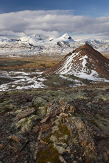
Icelandic horses in Fjardara valley, Borgarfjorur Eystri fjord, near Bakkagerdi, Mount Stadarfjall behind, East Fjords area, Iceland, Polar Regions
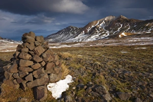
Cairn and mountains in Brunavik valley, a favourite for hikers, Borgarfjorur Eystri fjord, East Fjords area, Iceland, Polar Regions
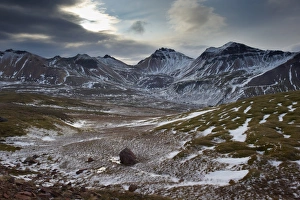
Mountains in Brunavik valley, a favourite for hikers, Borgarfjorur Eystri fjord, East Fjords area, Iceland, Polar Regions
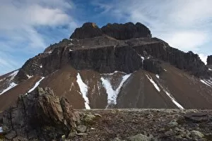
Mount Geitfell, 587m, , spectacular eroded peak on east shore of Borgarfjordur Eystri fjord, East Fjords, Iceland, Polar Regions
View over Fjardara valley, Borgarfjorur Eystri fjord, Bakkagerdi village and Mount Dyrfjoll (Door Mountain), 1136m, in the distance, from east side of the fjord, East Fjords area, Iceland
Bakkagerdi, village in Borgarfjordur Eystri fjord, East Fjords, Iceland, Polar Regions
Farms and sheep in Njardvik valley, Borgarfjordur Eystri fjord in the distance, East Fjords area, Iceland, Polar Regions
Road 94 in Njardvik valley, Borgarfjordur Eystri fjord in the distance, East Fjords area, Iceland, Polar Regions