mail_outline sales@mediastorehouse.com
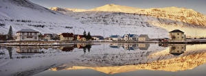
Panoramic view of Seydisfjordur and surrounding mountains, East Fjords, Iceland, Polar Regions
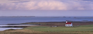
Church at Narfeyri, view over Breidafjordur (Hvammsfjordur), West Iceland, Iceland, Polar Regions
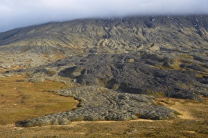
Lava fields, Snaefellsnes Peninsula, Iceland, Polar Regions
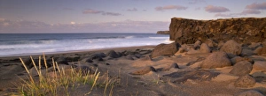
Skardsvik, white-sand beach bordered by lava flows in the north of Snaefellsjokull National Park, Snaefellsnes Peninsula, Iceland, Polar Regions
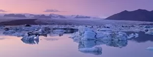
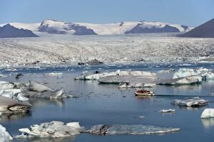
Jokulsarlon glacial lagoon, Breidamerkurjokull (Vatnajokull) glacier in the distance, Iceland, Polar Regions
Tourist boat in Jokulsarlon glacial lagoon on a sunny morning, East Iceland, Iceland, Polar Regions
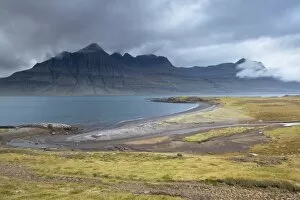
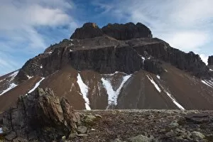
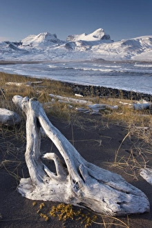
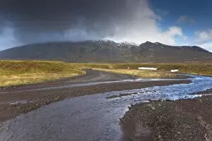
Mount Bulandstindur, 1069m, pyramid shaped stack of basaltic strata, in Berufjordur, East Fjords, Iceland, Polar Regions
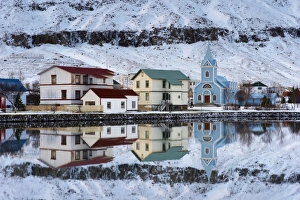
Traditional wooden church, built in 1922, at Seydisfjordur, a town founded in 1895 by a Norwegian fishing company, now main ferry port to and from Europe in the East Fjords, Iceland, Polar Regions
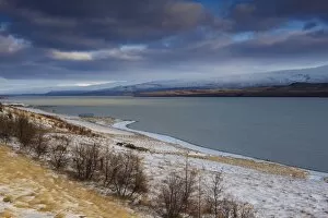
Lake Lagarfljot (Logurinn), near Egilsstadir, Fljotdalsherad valley, East Fjords area, Iceland, Polar Regions
Lake Lagarfljot (Logurinn), 53 square km and 25 km long, near Egilsstadir, Fljotdalsherad valley, East Fjords area, Iceland, Polar Regions
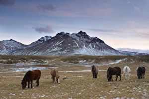
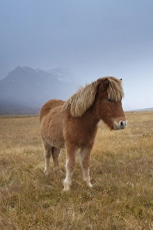
Icelandic horses in Fjardara valley, Borgarfjorur Eystri fjord, near Bakkagerdi, Mount Stadarfjall behind, East Fjords area, Iceland, Polar Regions
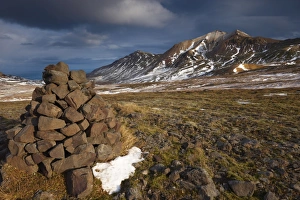
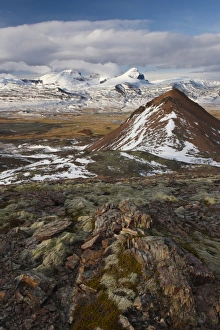
Cairn and mountains in Brunavik valley, a favourite for hikers, Borgarfjorur Eystri fjord, East Fjords area, Iceland, Polar Regions
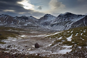
Mountains in Brunavik valley, a favourite for hikers, Borgarfjorur Eystri fjord, East Fjords area, Iceland, Polar Regions
Mount Geitfell, 587m, , spectacular eroded peak on east shore of Borgarfjordur Eystri fjord, East Fjords, Iceland, Polar Regions
View over Fjardara valley, Borgarfjorur Eystri fjord, Bakkagerdi village and Mount Dyrfjoll (Door Mountain), 1136m, in the distance, from east side of the fjord, East Fjords area, Iceland
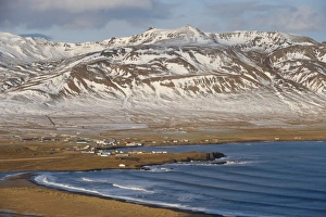
Bakkagerdi, village in Borgarfjordur Eystri fjord, East Fjords, Iceland, Polar Regions
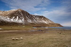
Farms and sheep in Njardvik valley, Borgarfjordur Eystri fjord in the distance, East Fjords area, Iceland, Polar Regions
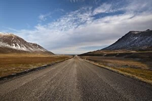
Road 94 in Njardvik valley, Borgarfjordur Eystri fjord in the distance, East Fjords area, Iceland, Polar Regions
View of Njardvik valley from the south, Borgarfjordur Eystri fjord in the distance, East Fjords area, Iceland, Polar Regions
Farm in Borgarfjordur Eystri fjord, Mount Burfell, 464m, on east shore of Borgarfjordur in the distance, East Fjords, Iceland, Polar Regions
Road in Borgarfjordur Eystri fjord, East Fjords, Iceland, Polar Regions
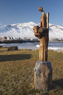
Wooden sculpture (trolls) at Bakkagerdi, Borgarfjordur Eystri, East Fjords area, Iceland, Polar Regions
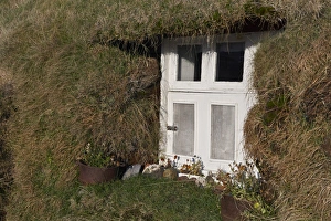
Lindarbakki turf house at Bakkagerdi, Borgarfjordur Eystri, East Fjords area, Iceland, Polar Regions
Yellow house at Os near Bakkagerdi in Borgarfjordur Eystri fjord, East Fjords, Iceland, Polar Regions
Yellow house and sheep at Os near Bakkagerdi in Borgarfjordur Eystri fjord, East Fjords, Iceland, Polar Regions
Driftwood on shores of Borgarfjordur Eystri fjord, Mount Dyrfjoll (Door mountain), 1136m, in background, East Fjords, Iceland, Polar Regions
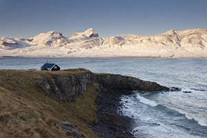
Small house and Borgarfjordur Eystri fjord, Mount Dyrfjoll (Door mountain), 1136m, in background, East Fjords, Iceland, Polar Regions
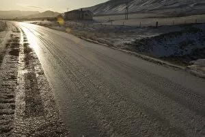
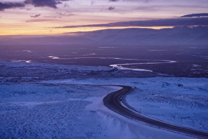
Road 94, Largarfjlot Valley north of Egilsstadir, at sunset, East Fjords, Iceland, Polar Regions
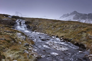
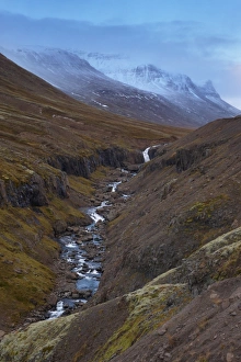
Frozen waterfall and stream in the East Fjords, near Neskaupstadur, Nordfjordur-Reydarfjordur, in winter, East Fjords, Iceland, Polar Regions
Icelandic horses and snow-capped mountains near Neskaupstadur in Nordjfordur fjord, one of the East Fjords, Iceland, Polar Regions
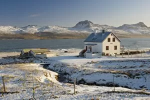
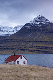
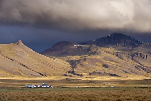
Red-roofed house and snow-capped mountains in Reydarfjordur fjord, East Fjords, Iceland, Polar Regions
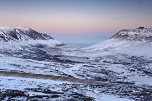
Sunset on snowy mountains in Reydarfjordur fjord, East Fjords, Iceland, Polar Regions
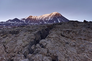
Deep crack in lava field near Lake Myvatn, Mount Hlidarfjall, 771m, in the distance, northern Iceland, Iceland, Polar Regions
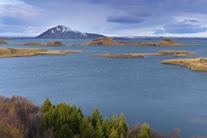
View of Lake Myvatn, from Hofdi on the east shore of the lake, with pseudo-craters and Mount Vindbelgjarfjall (Vindbelgur), 529m, in the distance, Myvatn area, Iceland, Polar Regions
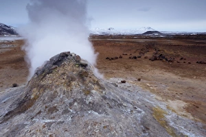
Steam vent at Namaskard geothermal area (Namafjall-Hverarond), Mount Burfell, 935m, behind, near Lake Myvatn and Reykjahlid, North Iceland, Iceland, Polar Regions
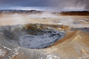
Mudpots at Namaskard geothermal area (Namafjall-Hverarond), near Lake Myvatn and Reykjahlid, North Iceland, Iceland, Polar Regions
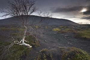
Desolate black ash landscape at the foot of Hverfjall (Hverfell) volcano, Myvatn, northern Iceland, Iceland, Polar Regions
Lake Myvatn, bird protected area in autumn, north-west shore of lake, looking eastwards, Hverfjall volcano visible in the distance, Myvatn, north Iceland, Iceland, Polar Regions
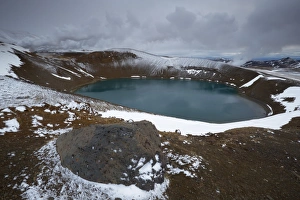
Crater lake Viti in winter, on Krafla volcano, Krafla geothermal area near Lake Myvatn, north Iceland, Iceland, Polar Regions
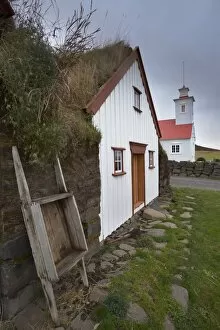
Laufas historic farmstead, north of Akureyri, Iceland, Polar Regions
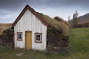
Laufas historic farmstead, the large turf farm house was built between 1866 and 1870, the present church in 1865, north of Akureyri, Iceland, Polar Regions
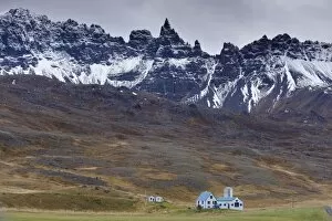
Farm and spectacular rocky spires, 1188 m, at Hals, in Oxnadalur valley, near Akureyri, north coast, Iceland, Polar Regions
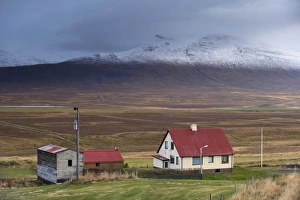
Farm and landscape in Vatsnes Peninsula, with snow-covered mountains in October, north coast of Iceland, Iceland, Polar Regions
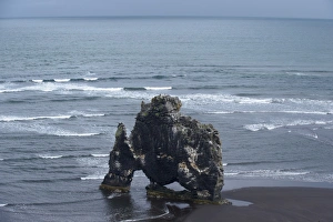
The distinctive sea stack Hvitserkur (White Shirt), Vatsnes Peninsula, North coast, Iceland, Polar Regions
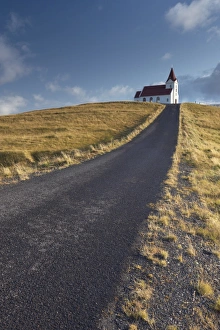
Ingjaldsholl church at Hellisandur, on border of Snaefellsjokull National Park, Snaefellsnes Peninsula, Iceland, Polar Regions
Mount Snaefellsjokull, 1446m high volcano covered by ice, Snaefellsjokull National Park, Snaefellsnes Peninsula, Iceland, Polar Regions
Lava flows on Mount Snaefellsjokull slopes, 1446m high volcano covered by ice, Snaefellsjokull National Park, Snaefellsnes Peninsula, Iceland, Polar Regions
Small church at Leira, near Borgarnes, Snokur and Heidarhorn mountains behind, West Iceland, Iceland, Polar Regions