mail_outline sales@mediastorehouse.com
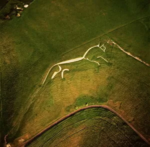
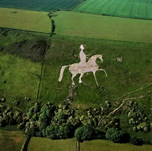
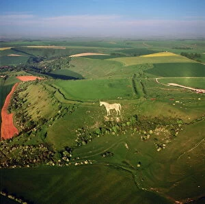
Aerial image of the Uffington White Horse, Berkshire Downs, Vale of White Horse, Oxfordshire, England, United Kingdom, Europe
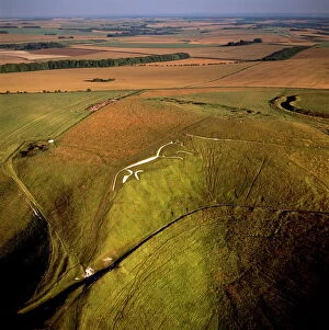
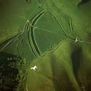
Aerial image of Uffington White Horse with Uffington Castle hill fort, Berkshire Downs, Vale of White Horse, Oxfordshire, England, United Kingdom, Europe
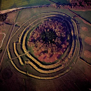
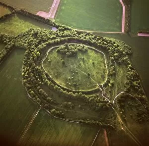
Aerial image of Badbury Rings, an Iron Age hill fort, Dorset, England, United Kingdom, Europe
Helvetia Wreck, Rhossili Bay, Gower, Wales, United Kingdom, Europe
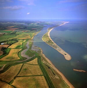
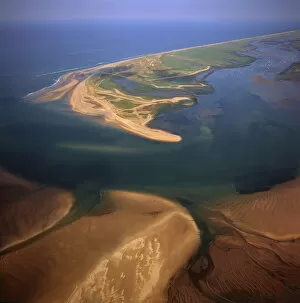
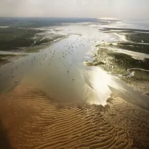
Aerial view of Orford Ness (Orfordness), a cuspate foreland shingle spit, Suffolk, England, United Kingdom, Europe
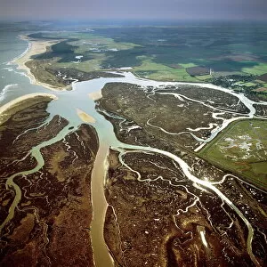
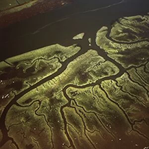
Aerial view of salt marsh at Burnham Overy Staithe, Norfolk, England, United Kingdom, Europe
Aerial image of Battlesbury Camp, an Iron Age Hill fort, Warminster, Wiltshire, England, United Kingdom, Europe
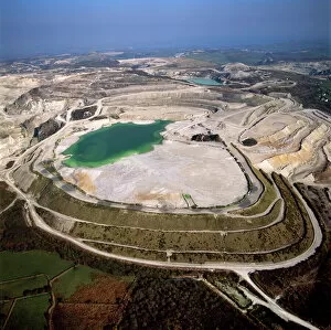
Aerial image of China Clay (Kaolin) Quarries, St. Austell, Cornwall, England, United Kingdom, Europe
Aerial image of Boscawen-Un Stone Circle, with gorse flowers, St. Buryan, Cornwall, England, United Kingdom, Europe
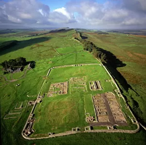
Aerial image of Housesteads Roman Fort of Vercovicium, an auxiliary fort on Hadrians Wall, UNESCO World Heritage Site, Northumberland, England, United Kingdom, Europe
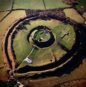
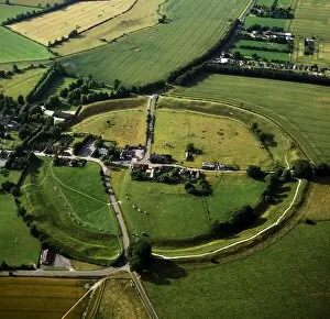
Aerial image of Old Sarum, the original site of Salisbury with castle ruins and cathedral foundations inside two high Iron Age banks (earthworks), Wiltshire, England, United Kingdom, Europe
Aerial image of Oldbury Camp Hill Fort with Cherhill White Horse, Cherhill Down, Calne, Wiltshire, England, United Kingdom, Europe
Aerial view of Blakeney Point, Norfolk, England, United Kingdom, Europe
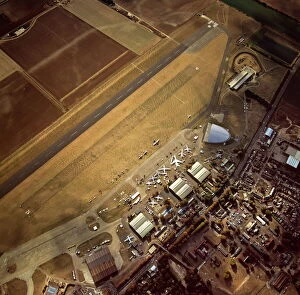
Aerial view of Duxford Aerodrome, now Imperial War Museum Duxford and the American Air Museum, Cambridgeshire, England, United Kingdom, Europe
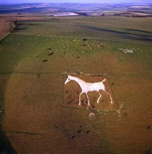
Aerial view of Osmington White Horse, Cherhill Downs, Osmington, Dorset, England, United Kingdom, Europe
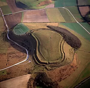
Aerial image of Danebury Ring, an Iron Age hill fort, Wiltshire, England, United Kingdom, Europe
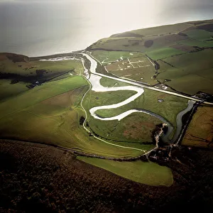
Aerial image of the Cuckmere River at Cuckmere Haven, Seven Sisters Country Park, East Sussex, England, United Kingdom, Europe
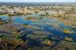
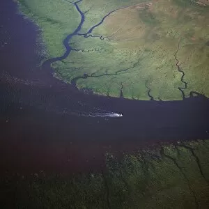
Aerial view of Okavango Delta, Botswana, Africa
Aerial image of Avebury, Neolithic Monument, site of a large henge and several stone circles, UNESCO World Heritage Site, Wiltshire, England, United Kingdom, Europe
Aerial image of Blakeney Point, Norfolk, England, United Kingdom, Europe
Aerial view of Alton Barnes White Horse, Alton Barnes, Wiltshire, England, United Kingdom, Europe
Aerial view of the Westbury White Horse and the Iron Age Bratton Camp Hill Fort, Wiltshire, England, United Kingdom, Europe
Aerial image of the River Esk flowing into Solway Firth, near Gretna Green, border between Cumbria in England and Dumfries and Galloway in Scotland, United Kingdom, Europe
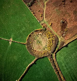
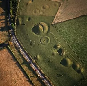
Aerial image of Winterbourne Poor Lot Round Barrows, Winterbourne Abbas, Dorset, England, United Kingdom, Europe
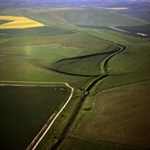
Aerial image of Wansdyke (from Wodens Dyke), an early medieval series of defensive linear earthworks, Tan Hill, Wiltshire, England, United Kingdom, Europe
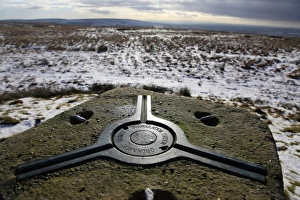
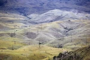
Looking west from an old Ordnance Survey triangulation point on The Chains above Blackmoor Gate in winter, Exmoor, Devon, England, United Kingdom, Europe
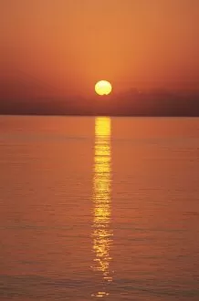
Sunrise over the Mediterranean Sea, Puerto Pollensa, Mallorca (Majorca), Balearic Islands, Spain, Europe
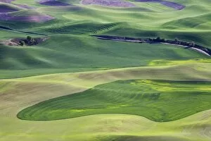
Field patterns at dawn, Palouse, Washington State, United States of America, North America
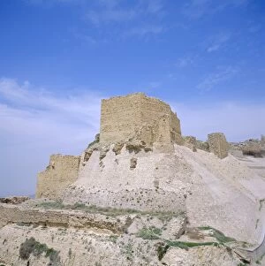
12th century Crusader castle in biblical land of Moab, Kerak, Jordan, Middle East
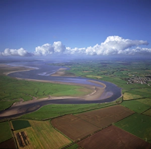
Aerial view of the mouth of Great Ouse River entering The Wash, Kings Lynn, Norfolk, England, United Kingdom, Europe
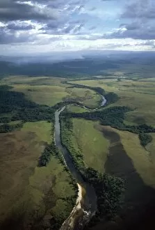
Aerial image of the confluence of Paikwa River with Kako River, Upper Mazaruni District, Guyana, South America
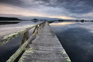
Tokaanu Wharf, Lake Taupo, North Island, New Zealand, Pacific
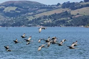
Adult spotted shags (Phalacrocorax punctatus) in flight in Dunedin, Otago, South Island, New Zealand, Pacific
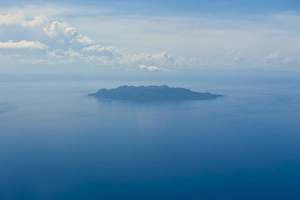
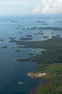
Aerial of the Sawo Island, Solomon Islands, Pacific
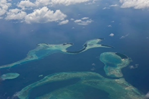
Aerial of the Russell Islands, Solomon Islands, Pacific
Aerial of the Marovo Lagoon, Solomon Islands, Pacific
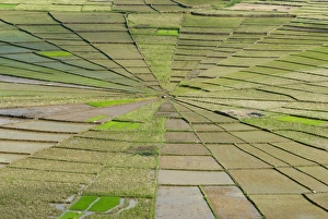
Rice field in spiders web shape, Region of Ruteng, Flores Island, Indonesia, Southeast Asia, Asia
Spring in the Palouse, from Steptoe Butte, Washington State, United States of America, North America
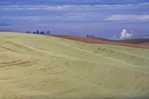
Genesee grain silo, Palouse, Idaho, United States of America, North America
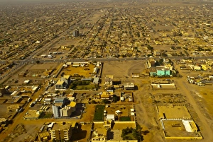
Aerial view of Khartoum, Sudan, Africa
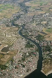
Aerial view of dormitory township on river into south end of Manila Bay, Manila, Philippines, Southeast Asia, Asia
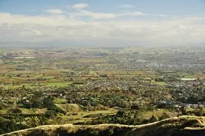
View of Havelock North and Hastings from Te Mata Peak, Hawkes Bay, North Island, New Zealand, Pacific
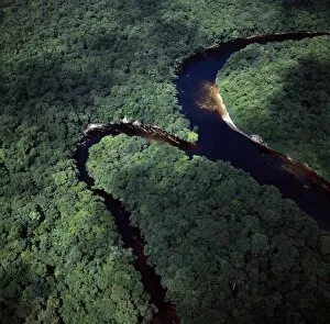
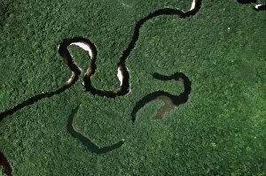
Aerial view of Rain Forest with Caroni River and Ox-Bows, Venezuela, South America
Aerial image of Yuruani River near Masu-paru-mota, Canaima National Park, UNESCO World Heritage Site, La Gran Sabana, Bolivar State, Venezuela, South America
Aerial image of skeleton forest, damaged by forest fire, on La Gran Sabana, Canaima National Park, UNESCO World Heritage Site, Bolivar State, Venezuela, South America
Aerial image of Salt Marsh on River Lune, Lancaster, Lancashire, England, United Kingdom, Europe
Aerial image of Lamb Down Military Badge, the badge of the Australian Commonwealth Military Forces, cut on a steep slope by the A36, Lamb Down, Wiltshire, England, United Kingdom, Europe
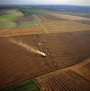
Aerial image of fields and harvest, Wiltshire, England, United Kingdom, Europe