mail_outline sales@mediastorehouse.com
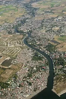
Aerial view of dormitory township on river into south end of Manila Bay, Manila, Philippines, Southeast Asia, Asia
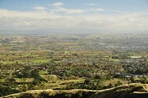
View of Havelock North and Hastings from Te Mata Peak, Hawkes Bay, North Island, New Zealand, Pacific
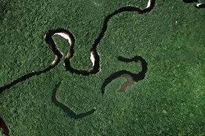
Aerial view of Rain Forest with Caroni River and Ox-Bows, Venezuela, South America
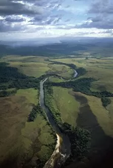
Aerial image of Yuruani River near Masu-paru-mota, Canaima National Park, UNESCO World Heritage Site, La Gran Sabana, Bolivar State, Venezuela, South America
Aerial image of skeleton forest, damaged by forest fire, on La Gran Sabana, Canaima National Park, UNESCO World Heritage Site, Bolivar State, Venezuela, South America
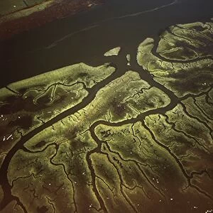
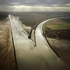
Aerial image of Salt Marsh on River Lune, Lancaster, Lancashire, England, United Kingdom, Europe
Aerial image of Lamb Down Military Badge, the badge of the Australian Commonwealth Military Forces, cut on a steep slope by the A36, Lamb Down, Wiltshire, England, United Kingdom, Europe
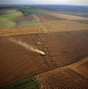
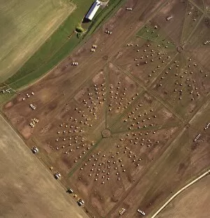
Aerial image of fields and harvest, Wiltshire, England, United Kingdom, Europe
Aerial image of Beacon Hill, an Iron Age hill fort, Burghclere, Hampshire, England, United Kingdom, Europe
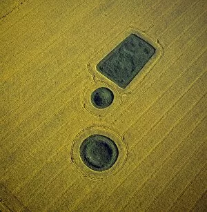
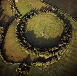
Aerial image of round and square Barrows at North Down in rape field, near Calstone Wellington, Wiltshire, England, United Kingdom, Europe
Aerial image of Bury Hill Fort, Wiltshire, England, United Kingdom, Europe
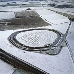
Aerial image of Yarnbury Castle, a hill fort, in snow, Wiltshire, England, United Kingdom, Europe
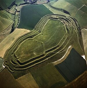
Aerial image of Maiden Castle, an Iron Age hill fort, Winterborne Monkton, near Dorchester, Dorset, England, United Kingdom, Europe
Aerial image of a pig farm, Wiltshire, England, United Kingdom, Europe
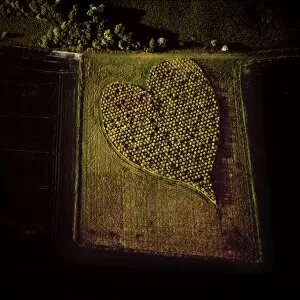
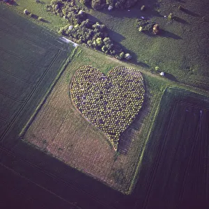
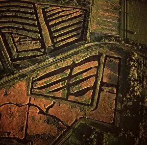
Aerial image of heart shape orchard, near Huish Hill earthwork, Oare, Wiltshire, England, United Kingdom, Europe
Aerial image of Black Buoy Sand, The Scalp, The Haven, Frampton Marsh, The Wash, Lincolnshire, England, United Kingdom, Europe
Aerial image of salt marsh at Tibby Head, Blakeney Point, Norfolk, England, United Kingdom, Europe
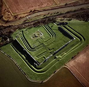
Aerial image of Richborough Roman fort (Rutupi), Kent, England, United Kingdom, Europe
Aerial view of Meggs Hill (Gog Magog Downs) (Gog Magog Hills) (the Gogs), a range of low chalk hills, Cambridgeshire, England, United Kingdom, Europe
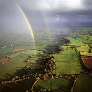
Aerial image of a double rainbow over the Somerset Levels, Somerset, England, United Kingdom, Europe
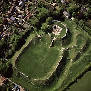
Aerial view of Castle Acre, remains of a motte and bailey castle with extensive earthworks, Castle Acre, Norfolk, England, United Kingdom, Europe
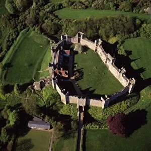
Aerial view of Framlingham Castle, Framlingham, Suffolk, England, United Kingdom, Europe
Aerial image of peat extraction, Westhay Moor, near Glastonbury, Somerset, England, United Kingdom, Europe
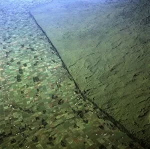
Aerial view of of Virunga National Park (Parc National des Volcans) showing the boundary of the park and agricultural land, Virunga Volcanoes, Rwanda, Africa
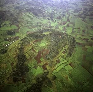
Aerial view of intensive agriculture on Virunga foothills, Rwanda, Africa
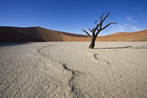
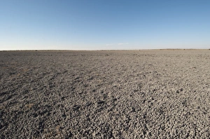
Snaking line in the earth, Dead Vlei, Sossusvlei, Namib-Naukluft Park, Namib Desert, Namibia, Africa
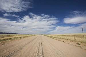
Empty gravel road going north from Sossusvlei, Central Namibia, Namibia, Africa
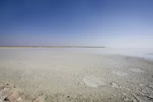
Track into Etosha Pan, Etosha National Park, Namibia, Africa
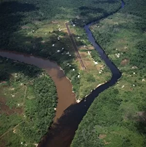
Aerial image of Kamarang Mouth Station and airstrip at the confluence of the unpolluted Kamarang River with the mined and heavily polluted Upper Mazaruni River in March 2005, Guyana, South America
Deception Valley, Central Kalahari Game Reserve, Botswana, Africa
Park National Volcan Masaya, Masaya, Nicaragua, Central America
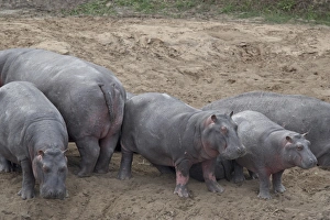
Hippopotamus (Hippopotamus amphibius) on land, Masai Mara National Reserve, Kenya, East Africa, Africa
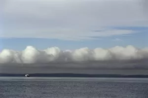
Ferry route from West Seattle to Vashon Island, Puget Sound, Washington State, United States of America (U.S.A.), North America
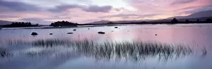
Loch Ba at sunrise, Rannoch Moor, Western Highlands, Scotland, United Kingdom, Europe
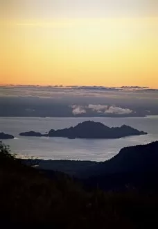
Island view from Puyehue volcano, Lago Puyehue (Lake Puyehue), Chile, South America
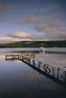
Boat and jetty, Nova Scotia, Canada, North America