mail_outline sales@mediastorehouse.com
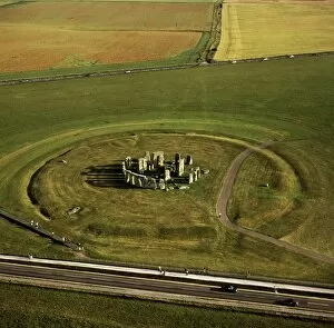
Aerial image of Stonehenge, prehistoric monument and stone circle, UNESCO World Heritage Site, Salisbury Plain, Wiltshire, England, United Kingdom, Europe
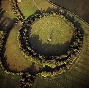
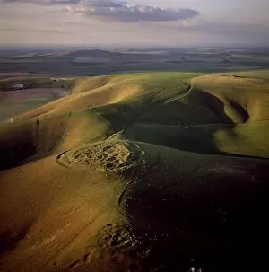
Aerial image of Beacon Hill, an Iron Age hill fort, Burghclere, Hampshire, England, United Kingdom, Europe
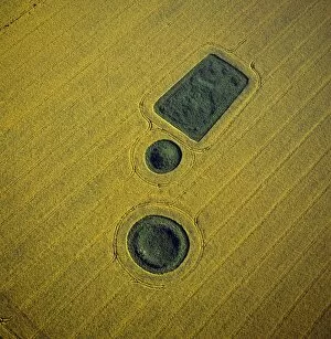
Aerial image of round and square Barrows at North Down in rape field, near Calstone Wellington, Wiltshire, England, United Kingdom, Europe
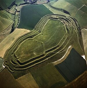
Aerial image of Bury Hill Fort, Wiltshire, England, United Kingdom, Europe
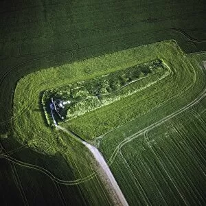
Aerial image of West Kennet Long Barrow, a Neolithic tomb or barrow, on a prominent chalk ridge, near Silbury Hill, Avebury, Wiltshire, England, United Kingdom, Europe
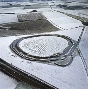
Aerial image of Yarnbury Castle, a hill fort, in snow, Wiltshire, England, United Kingdom, Europe
Aerial image of Maiden Castle, an Iron Age hill fort, Winterborne Monkton, near Dorchester, Dorset, England, United Kingdom, Europe
Aerial image of Carisbrooke Castle, a historic motte-and-bailey castle, Carisbrooke, near Newport, Isle of Wight, England, United Kingdom, Europe
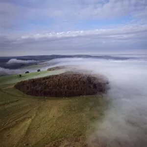
Aerial image of Rybury Camp, an Iron Age hill fort with Neolithic causewayed enclosure, Wiltshire, England, United Kingdom, Europe
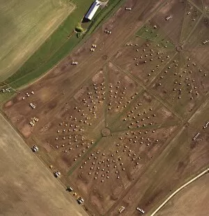
Aerial image of a pig farm, Wiltshire, England, United Kingdom, Europe
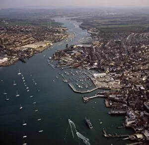
Aerial image of Cowes, on the west bank of the estuary of the River Medina facing the smaller town of East Cowes on the east bank, Isle of Wight. England, United Kingdom, Europe
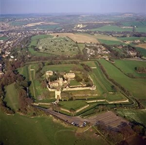
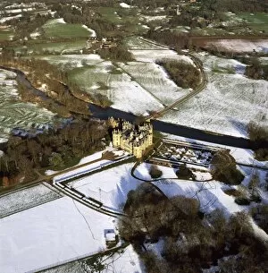
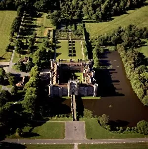
Aerial image of Longford Castle in snow, south of Salisbury, Wiltshire, England, United Kingdom, Europe
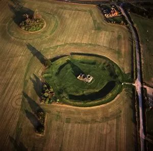
Aerial image of Knowlton Henge, a Neolithic henge monument, and Knowlton Church, a ruined Norman church, Dorset, England, United Kingdom, Europe
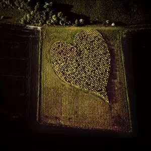
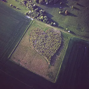
Aerial image of heart shape orchard, near Huish Hill earthwork, Oare, Wiltshire, England, United Kingdom, Europe
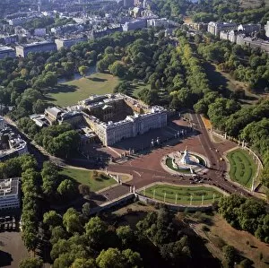
Aerial image of Buckingham Palace, City of Westminster, London, England, United Kingdom, Europe
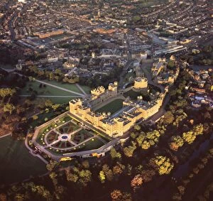
Aerial image of Windsor Castle, the largest inhabited castle in the world, Windsor, Berkshire, England, United Kingdom, Europe
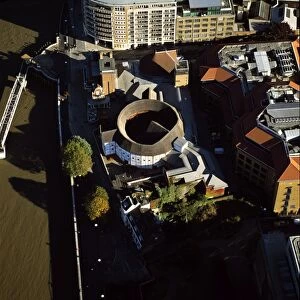
Aerial image of the Globe Theatre (Shakespeares Globe) and the River Thames, London, England, United Kingdom, Europe
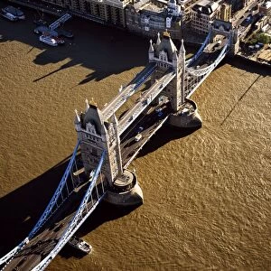
Aerial image of Tower Bridge, a combined bascule and suspension bridge, over the River Thames, London, England, United Kingdom, Europe
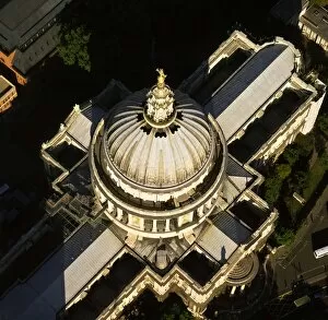
Aerial image of St. Pauls Cathedral, Ludgate Hill, City of London, London, England, United Kingdom, Europe
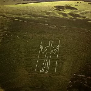
Aerial image of the Long Man of Wilmington, Wilmington, East Sussex, England, United Kingdom, Europe
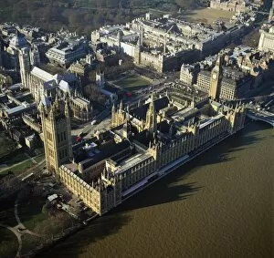
Aerial image of the Houses of Parliament (Palace of Westminster) and Big Ben, UNESCO World Heritage Site, Westminster, London, England, United Kingdom, Europe
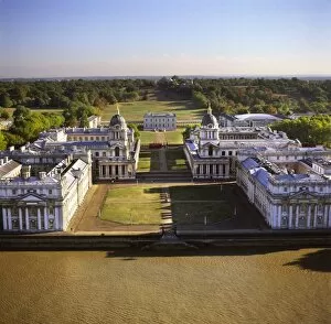
Aerial image of the Royal Naval College and Queens House, on the south bank of the River Thames, UNESCO World Heritage Site, with the Royal Observatory in the background, Greenwich, London, England
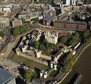
Aerial image of the Tower of London, UNESCO World Heritage Site, London, England, United Kingdom, Europe
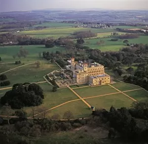
Aerial image of Osborne House, Isle of Wight, England, United Kingdom, Europe
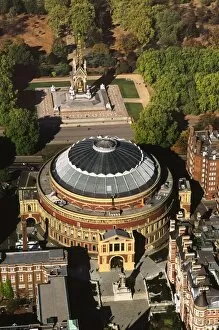
Aerial image of the Royal Albert Hall, and the Albert Memorial in Kensington Gardens, London, England, United Kingdom, Europe
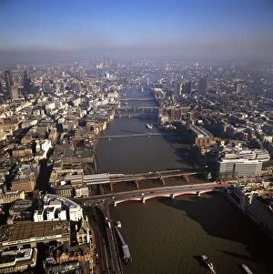
Aerial image of bridges over the River Thames, looking east from Blackfriars Bridge, London, England, United Kingdom, Europe
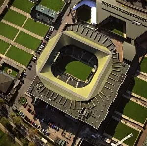
Aerial image of Centre Court, All-England Club (All England Lawn Tennis and Croquet Club), Wimbledon, London, England, United Kingdom, Europe
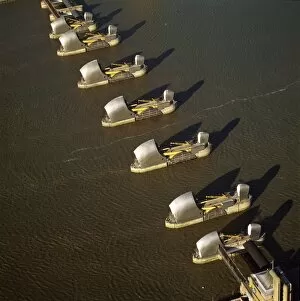
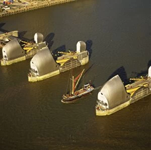
Aerial image of the Thames Flood Barrier across the River Thames, Woolwich Reach, Woolwich, London, England, United Kingdom, Europe
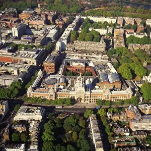
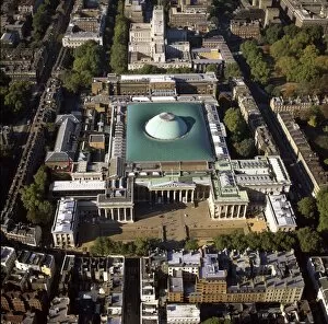
Aerial image of the Victoria and Albert Museum, Albertopolis, South Kensington, London, England, United Kingdom, Europe
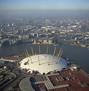
Aerial image of the Millennium Dome and the River Thames, Greenwich Peninsula, South East London, London, England, United Kingdom, Europe
Aerial image of Thames sailing barge and Thames Flood Barrier across the River Thames, Woolwich Reach, Woolwich, London, England, United Kingdom, Europe
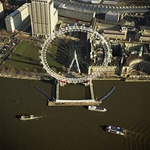
Aerial image of the London Eye (Millennium Wheel), South Bank of the River Thames, London, England, United Kingdom, Europe
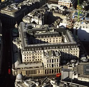
Aerial image of the Bank of England, City of London, London, England, United Kingdom, Europe
Aerial image of the Science Museum, Albertopolis, Exhibition Road, South Kensington, London, England, United Kingdom, Europe
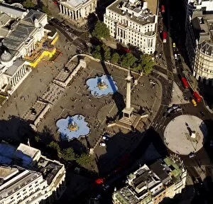
Aerial image of Trafalgar Square including Nelsons Column, London, England, United Kingdom, Europe
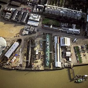
Aerial image of Chatham Historic Dockyard, a maritime museum, Chatham, Kent, England, United Kingdom, Europe
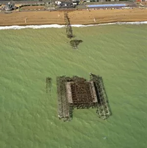
Aerial image of the burnt-out West Pier, Brighton, Sussex, England, United Kingdom, Europe
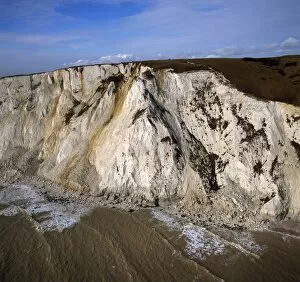
Aerial image of Beachy Head, a chalk headland, the highest chalk sea cliff in Britain, near Eastbourne, East Sussex, England, United Kingdom, Europe
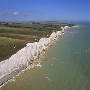
Aerial image of the chalk cliffs of the Seven Sisters, with Belle Tout lighthouse and Beachy Head in the distance, East Sussex, England, United Kingdom, Europe
Aerial image of Deal Castle, a Device fort (Henrician Castle) built by Hentry VIII, Deal, Kent, England, United Kingdom, Europe
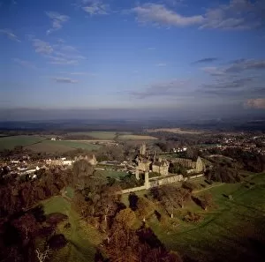
Aerial image of Herstmonceux Castle, a brick-built Tudor castle near Herstmonceux, East Sussex, England, United Kingdom, Europe
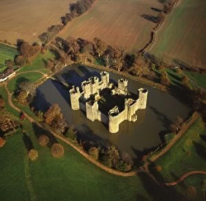
Aerial image of Bodiam Castle, late medieval moated castle, Robertsbridge, East Sussex, England, United Kingdom, Europe
Aerial image of Battle Abbey (St. Martins Abbey), built on the scene of the Battle of Hastings and dedicated to St. Martin, Battle, East Sussex, England, United Kingdom, Europe
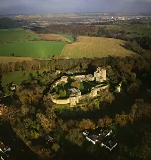
Aerial image of Saltwood Castle, near Hythe, Kent, England, United Kingdom, Europe
Aerial image of Arundel Park near Arundel Castle, South Downs, West Sussex, England, United Kingdom, Europe
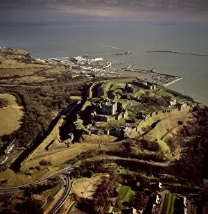
Aerial image of Dover Castle with Dover Harbour beyond, Kent, England, United Kingdom, Europe
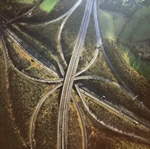
Aerial image of M25 and M23 Motorway Junction, Surrey, England, United Kingdom, Europe