mail_outline sales@mediastorehouse.com
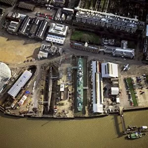
Aerial image of Chatham Historic Dockyard, a maritime museum, Chatham, Kent, England, United Kingdom, Europe
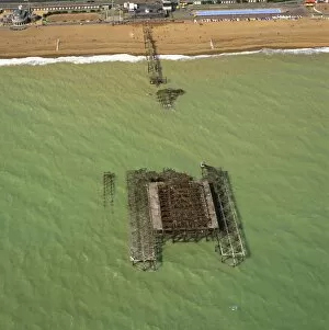
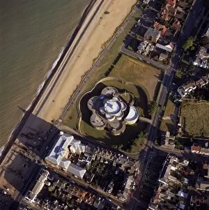
Aerial image of the burnt-out West Pier, Brighton, Sussex, England, United Kingdom, Europe
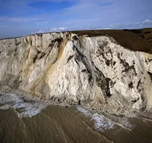
Aerial image of Beachy Head, a chalk headland, the highest chalk sea cliff in Britain, near Eastbourne, East Sussex, England, United Kingdom, Europe
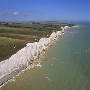
Aerial image of the chalk cliffs of the Seven Sisters, with Belle Tout lighthouse and Beachy Head in the distance, East Sussex, England, United Kingdom, Europe
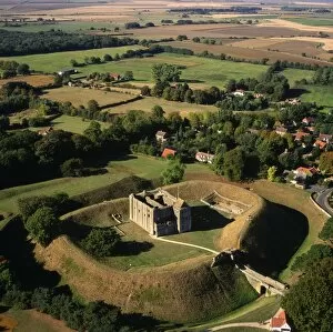
Aerial image of Deal Castle, a Device fort (Henrician Castle) built by Hentry VIII, Deal, Kent, England, United Kingdom, Europe
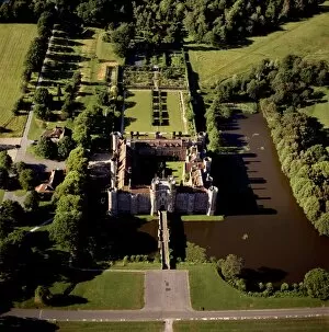
Aerial image of Herstmonceux Castle, a brick-built Tudor castle near Herstmonceux, East Sussex, England, United Kingdom, Europe
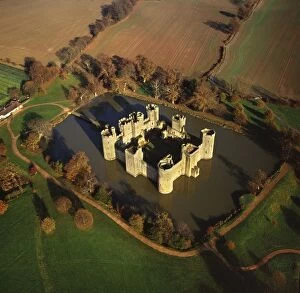
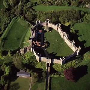
Aerial image of Bodiam Castle, late medieval moated castle, Robertsbridge, East Sussex, England, United Kingdom, Europe
Aerial image of Battle Abbey (St. Martins Abbey), built on the scene of the Battle of Hastings and dedicated to St. Martin, Battle, East Sussex, England, United Kingdom, Europe
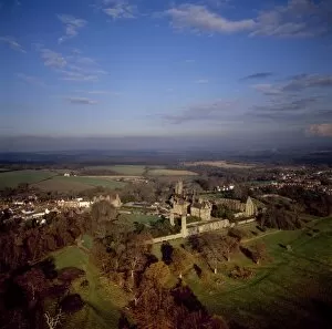
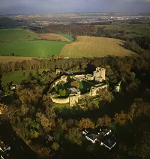
Aerial image of Saltwood Castle, near Hythe, Kent, England, United Kingdom, Europe
Aerial image of Arundel Park near Arundel Castle, South Downs, West Sussex, England, United Kingdom, Europe
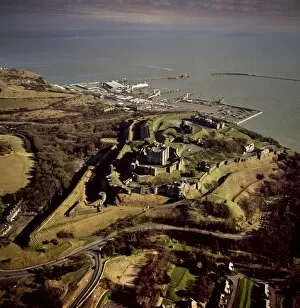
Aerial image of Dover Castle with Dover Harbour beyond, Kent, England, United Kingdom, Europe
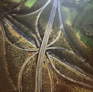
Aerial image of M25 and M23 Motorway Junction, Surrey, England, United Kingdom, Europe
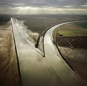
Aerial image of Black Buoy Sand, The Scalp, The Haven, Frampton Marsh, The Wash, Lincolnshire, England, United Kingdom, Europe
Aerial image of salt marsh at Tibby Head, Blakeney Point, Norfolk, England, United Kingdom, Europe
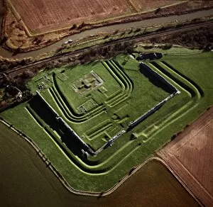
Aerial image of Richborough Roman fort (Rutupi), Kent, England, United Kingdom, Europe
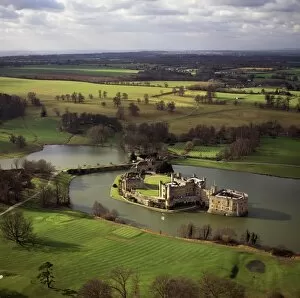
Aerial image of Leeds Castle and moat, a medieval castle, southeast of Maidstone, Kent, England, United Kingdom, Europe
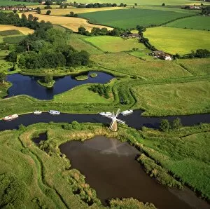
Aerial view of the River Ant, Norfolk Broads, near How Hill, Norfolk, England, United Kingdom, Europe
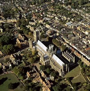
Aerial view of Ely Cathedral, (Cathedral Church of the Holy and Undivided Trinity), known as the Ship of the Fens, Ely, Cambridgeshire, England, United Kingdom, Europe
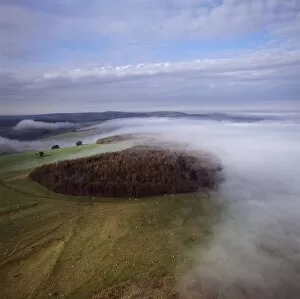
Aerial view of Meggs Hill (Gog Magog Downs) (Gog Magog Hills) (the Gogs), a range of low chalk hills, Cambridgeshire, England, United Kingdom, Europe
Aerial view of Castle Rising, a medieval castle, Norfolk, England, United Kingdom, Europe
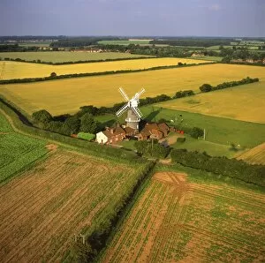
Aerial view of Bircham Windmill, Great Bircham, Kings Lynn, Norfolk, England, United Kingdom, Europe
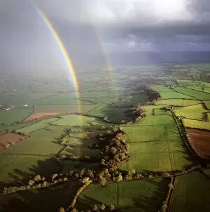
Aerial image of a double rainbow over the Somerset Levels, Somerset, England, United Kingdom, Europe
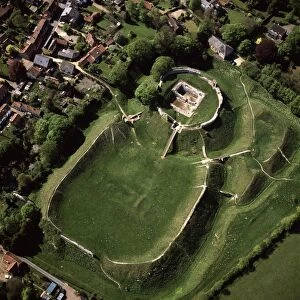
Aerial view of Castle Acre, remains of a motte and bailey castle with extensive earthworks, Castle Acre, Norfolk, England, United Kingdom, Europe
Aerial view of Framlingham Castle, Framlingham, Suffolk, England, United Kingdom, Europe
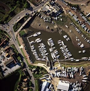
Aerial view of Foxs, Marina, Ipswich, Suffolk, England, United Kingdom, EuropeAerial view of Fox s, Marina, Ipswich, Suffolk, England, United Kingdom, Europe
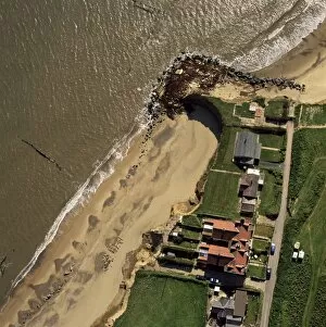
Aerial view of Happisburgh, showing precarious position of several houses as cliffs are eroded by coastal erosion, Norfolk, England, United Kingdom, Europe
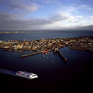
Aerial view of Harwich International Port, one of the Haven ports, Essex, England, United Kingdom, Europe
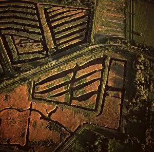
Aerial image of peat extraction, Westhay Moor, near Glastonbury, Somerset, England, United Kingdom, Europe
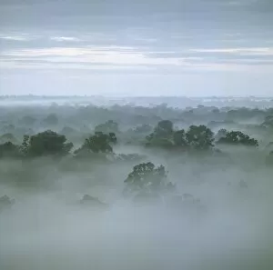
Tropical rain forest at dawn, Raleighvallen Voltzberg National Park, Suriname, South America
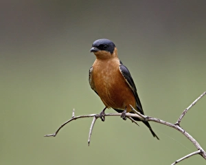
Red-Breasted Swallow (Hirundo semirufa), Hluhluwe Game Reserve, South Africa, Africa
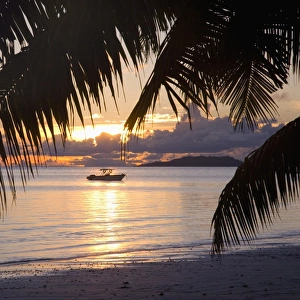
Small boat moored off the beach at Anse Volbert at sunrise, Baie Sainte Anne district, Island of Praslin, Seychelles, Indian Ocean, Africa
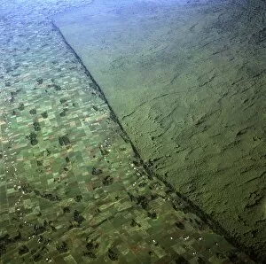
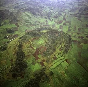
Aerial view of of Virunga National Park (Parc National des Volcans) showing the boundary of the park and agricultural land, Virunga Volcanoes, Rwanda, Africa
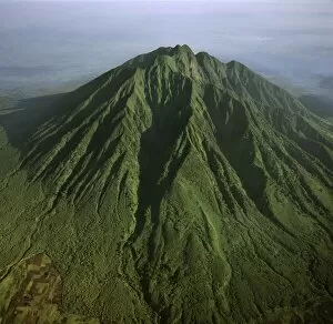
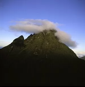
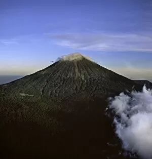
Aerial view of Mount Sabyinyo, an extinct volcano and oldest of the Virunga Mountains, the summit at 3645metres marks the intersection of the borders of Democratic Republic of the Congo (DRC)
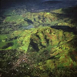
Aerial view of intensive agriculture on Virunga foothills, Rwanda, Africa
Aerial view of Mount Mikeno, Virunga Volcanoes, Rwanda, Great Rift Valley, Africa
Aerial view of intensive agriculture in Rwanda, Africa
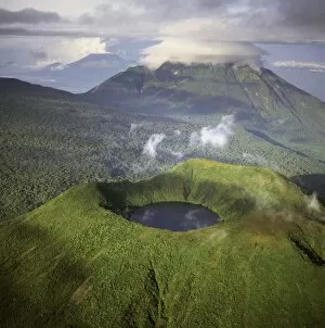
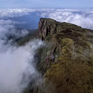
Aerial view of Mount Visoke (Mount Bisoke), an extinct volcano straddling the border of Rwanda and Democratic Republic of the Congo (DRC) showing crater lake, with Mount Mikeno in background
Aerial view of Mount Karisimbi, a dormant volcano in the Virunga Mountains on the border between Rwanda and the Democratic Republic of Congo (DRC), at 4507m the highest of the mountain range
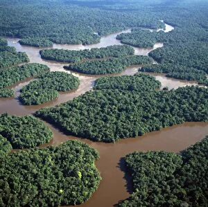
Aerial image of the Lower Mazaruni River south of Oranapai Landing, Guyana, South America
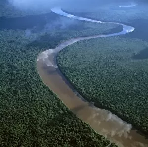
Aerial image of the Lower Mazaruni River with islands of tropical rain forest, Hororabo, near Bartica, Guyana, South America
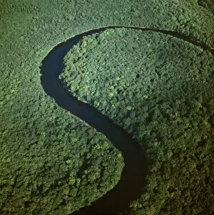
Aerial image of the Kako River, Upper Mazaruni District, Guyana, South America
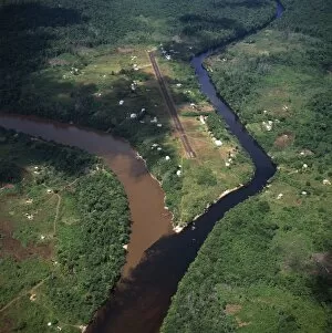
Aerial image of Kamarang Mouth Station and airstrip at the confluence of the unpolluted Kamarang River with the mined and heavily polluted Upper Mazaruni River in March 2005, Guyana, South America
Aerial image of the Upper Mazaruni River, downstream from Kamarang, Guyana, South America
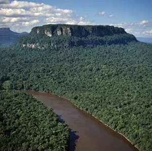
Aerial image of Ayanganna Mountain, Guyana, South America
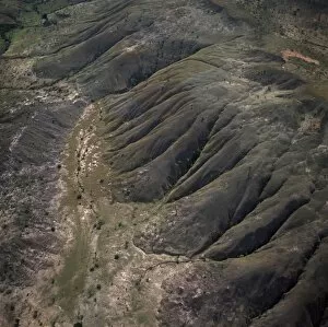
Aerial view of highland savannah and erosion, near Ireng River, Rupununi District, Guyana, South America
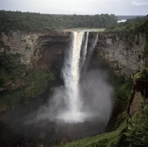
Kaieteur Falls, Potaro River, dry season, Guyana, South Amrica
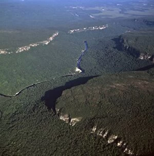
Aerial image of Chi-Chi Gorge, downstream from Chi-Chi Falls, Upper Mazaruni River, Upper Mazaruni District, Guyana, South America
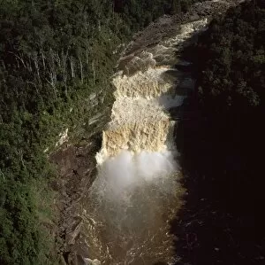
Aerial image of the Peaima Falls, Upper Mazaruni River, Guyana, South America