mail_outline sales@mediastorehouse.com
Snow capped mountains above Stresa, Isola Bella and Isola Superiore, Borromean Islands, Lake Maggiore, Italian Lakes, Piedmont, Italy, Europe
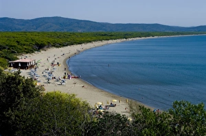
Ortobello, Capraia, Tuscany, Italy, Europe
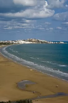
Vieste beach, Gargano coast, Adriatic, Puglia, Italy, Europe
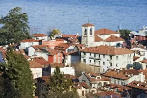
Rooftops in the town of Stresa, on Lake Maggiore, Italian Lakes, Piedmont, Italy, Europe
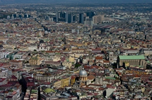
Cityscape, Naples, Campania, Italy, Europe
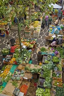
Mercado dos Lavradores, the covered market for producers of island food, Funchal, Madeira, Portugal, Europe
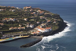
The village of Seixal on a peninsula on the north coast of the island of Madeira, Portugal, Atlantic, Europe
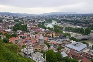
View over Tiblisi, Georgia, Caucasus, Central Asia, Asia
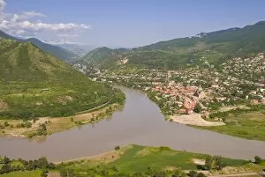
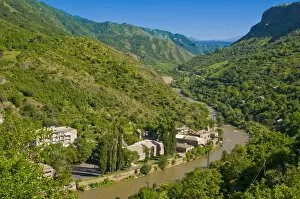
View over the Mtkvari River and Mtskheta, Georgia, Caucasus, Central Asia, Asia
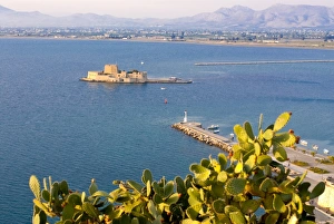
View to one of the castles guarding Nafplio, Peloponnese, Greece, Europe
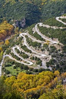
Serpentine road in the Zagorohroia mountains, Greece, Europe
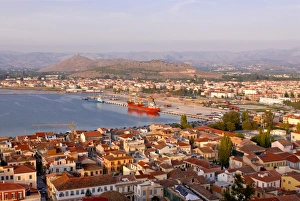
View over the town of Nafplio, Peloponnese, Greece, Europe
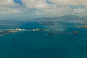
Aerial view of the island of Grand Terre, Mayotte, French Departmental Collectivity of Mayotte, Indian Ocean, Africa
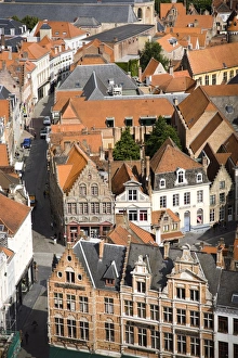
Aerial view of medieval city of Bruges, UNESCO World Heritage Site, Belgium, Europe
View over the Debed Canyon, Armenia, Caucasus, Central Asia, Asia
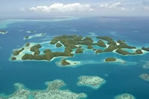
Seventy Islands (Ngerukewid Islands Wildlife Preserve), forest-covered limestone rock, protected as a Nature Reserve, so can only be seen from the air, Palau, Micronesia, Western Pacific Ocean
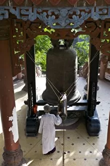
Nun ringing a giant bell, Long Son Pagoda, Vietnam, Indochina, Southeast Asia, Asia
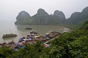
View from Sung Sot Cave, UNESCO World Heritage Site, Halong Bay, Vietnam, Indochina, Southeast Asia, Asia
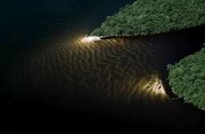
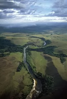
Aerial view of Rain Forest, Caroni River with sandbars, Venezuela, South America
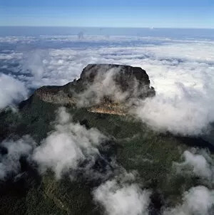
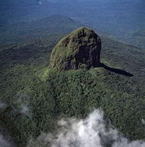
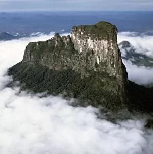
Aerial image of Tramentepui, Eastern chain of tepuis, Estado Bolivar, Venezuela, South America
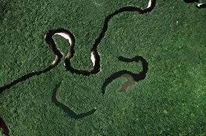
Aerial view of Rain Forest with Caroni River and Ox-Bows, Venezuela, South America
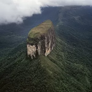
Aerial image of Weiassipu, Eastern chain of tepuis, Estado Bolivar, Venezuela, South America
Aerial image of Wadakapiapetepui, Eastern chain of tepuis, Estado Bolivar, Venezuela, South America
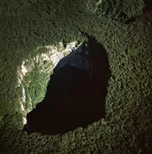
Aerial image of tepuis and Sarisarinama Sinkhole, Jaua-Sarisarinama National Park, Bolivar State, Venezuela, South America
Aerial image of tepuis showing Akopantepui, Gran Sabana, Estado Bolivar, Venezuela, South America
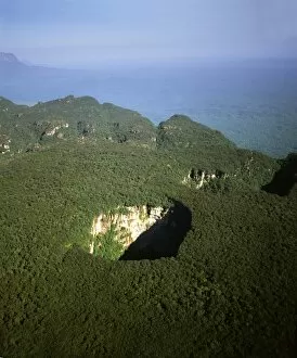
Aerial image of Sarisarinama Sinkhole, Jaua-Sarisarinama National Park, Tepuis, Bolivar State, Venezuela, South America
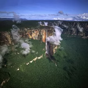
Aerial image of tepuis showing Angel Falls and Mount Auyantepui (Auyantepuy) (Devils Mountain), Venezuela, South America
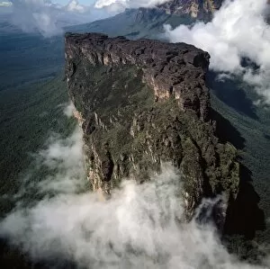
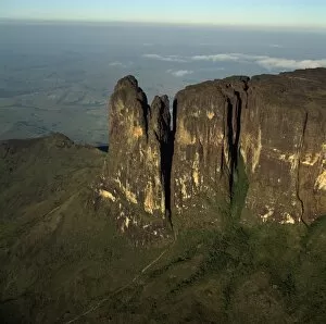
Aerial image of tepuis showing south side of Auyantepui (Auyantepuy) (Devils Mountain) from Uruyen valley, Canaima National Park, UNESCO World Heritage Site, Venezuela, South America
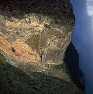
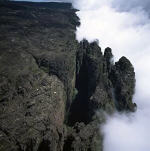
Aerial image of tepuis showing southeast corner and Towashing Pinnacle (Tewasen), Mount Roraima, Venezuela, South America
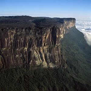
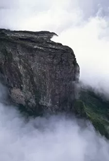
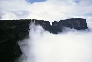
Aerial image of tepuis showing eastern cliff looking towards Brazil and Guyana, Mount Roraima, Venezuela, South America
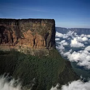
Aerial image of tepuis showing northern prow in the Guyanese sector of Mount Roraima (Cerro Roraima), Venezuela, South America
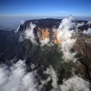
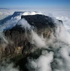
Aerial image of tepuis showing Mount Roraima (Cerro Roraima), Venezuela, South America
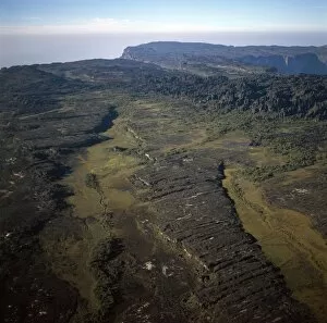
Aerial image of tepuis showing swamps and rock labyrinths on summit plateau in Brazilian and Guyanese sectors, Mount Roraima, Venezuela, South America
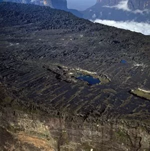
Aerial image of tepuis showing the summit of Mount Roraima (Cerro Roraima) with Lake Gladys, Venezuela, South America
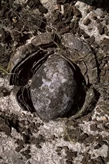
Eroded granite near Mount Roraima, Gran Sabana, Estado Bolivar, Venezuela, South America
Aerial view of the eastern cliff of Mount Kukenaam (Kukenan) (Cuguenan), Venezuela, South America
Aerial image of tepuis showing Mount Kukenaam (Kukenan) (Cuguenan), Venezuela, South America
Aerial image of northern section of Mount Kukenaam (Kukenan) (Cuguenan), Estado Bolivar, Venezuela, South America
Aerial view of northern section of Mount Kukenaam (Kukenan) (Cuguenan), Venezuela, South America
Aerial image of tepuis showing the Great Crack and summit of Mount Kukenaam (Kukenan) (Cuguenan), Estado Bolivar, Venezuela, South America
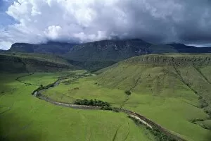
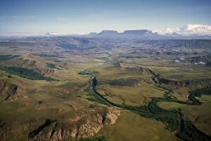
Aerial image of River Kukenan looking north to tepuis of Mount Kukenaam (Kukenan) (Cuguenan) and Mount Roraima, Gran Sababa, Venezuela, South America
Aerial image of tepuis showing Mount Autana (Cerro Autana), Amazonas territory, Venezuela, South America
Black frog (Oreophrynella quelchii), Roraima summit, Venezuela, South America
Aerial image of Yuruani River near Masu-paru-mota, Canaima National Park, UNESCO World Heritage Site, La Gran Sabana, Bolivar State, Venezuela, South America
Orecchiette (little ears), a type of pasta of Apulia, with broccoli rabe and salted fish (Orecchiette con cime di rapa), Italy, Europe
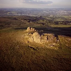
Aerial image of Haytor (Hay Tor) and Haytor Rocks, granite rock outcrop, Haytor Vale, Dartmoor, Devon, England, United Kingdom, Europe
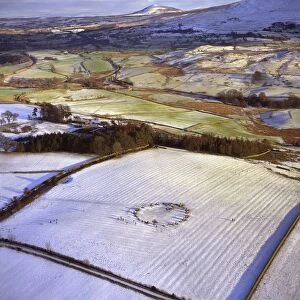
Aerial image of Castlerigg Stone Circle, a prehistoric monument in snow, near Keswick, Lake District National Park, Cumbria, England, United Kingdom, Europe
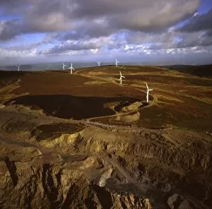
Aerial image of wind farm at Kirkby Moor, Cumbria, England, United Kingdom, Europe