mail_outline sales@mediastorehouse.com
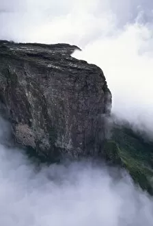
Aerial image of tepuis showing Mount Kukenaam (Kukenan) (Cuguenan), Venezuela, South America
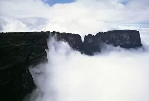
Aerial image of northern section of Mount Kukenaam (Kukenan) (Cuguenan), Estado Bolivar, Venezuela, South America
Aerial view of northern section of Mount Kukenaam (Kukenan) (Cuguenan), Venezuela, South America
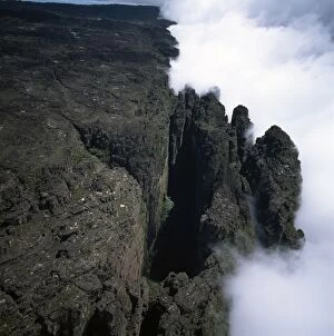
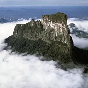
Aerial image of tepuis showing the Great Crack and summit of Mount Kukenaam (Kukenan) (Cuguenan), Estado Bolivar, Venezuela, South America
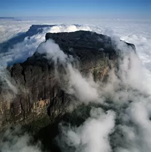
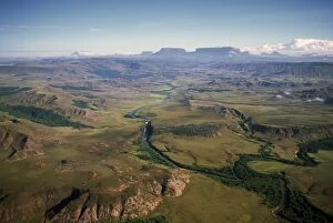
Aerial image of River Kukenan looking north to tepuis of Mount Kukenaam (Kukenan) (Cuguenan) and Mount Roraima, Gran Sababa, Venezuela, South America
Aerial image of tepuis showing Mount Autana (Cerro Autana), Amazonas territory, Venezuela, South America
Black frog (Oreophrynella quelchii), Roraima summit, Venezuela, South America
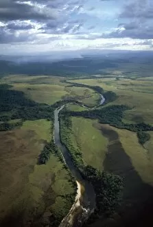
Aerial image of Yuruani River near Masu-paru-mota, Canaima National Park, UNESCO World Heritage Site, La Gran Sabana, Bolivar State, Venezuela, South America
Orecchiette (little ears), a type of pasta of Apulia, with broccoli rabe and salted fish (Orecchiette con cime di rapa), Italy, Europe
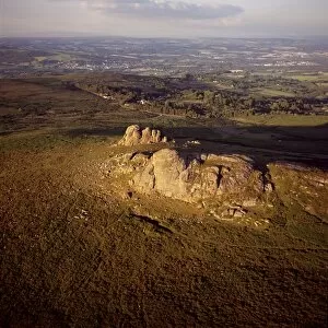
Aerial image of Haytor (Hay Tor) and Haytor Rocks, granite rock outcrop, Haytor Vale, Dartmoor, Devon, England, United Kingdom, Europe
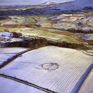
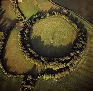
Aerial image of Castlerigg Stone Circle, a prehistoric monument in snow, near Keswick, Lake District National Park, Cumbria, England, United Kingdom, Europe
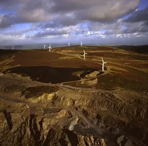
Aerial image of wind farm at Kirkby Moor, Cumbria, England, United Kingdom, Europe
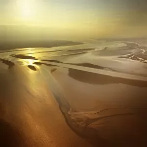
Aerial image of mudflats at sunset, Solway Firth, border between Cumbria in England and Dumfries and Galloway in Scotland, United Kingdom, Europe
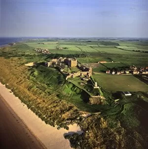
Aerial image of Bamburgh Castle, a Norman castle built on a basalt outcrop on the coast, Bamburgh, Northumberland, England, United Kingdom, Europe
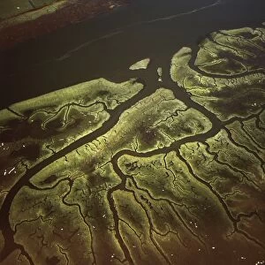
Aerial image of Salt Marsh on River Lune, Lancaster, Lancashire, England, United Kingdom, Europe
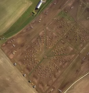
Aerial image of Lamb Down Military Badge, the badge of the Australian Commonwealth Military Forces, cut on a steep slope by the A36, Lamb Down, Wiltshire, England, United Kingdom, Europe
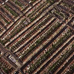
Aerial image of terraced housing, Portsmouth, Hampshire, England, United Kingdom, Europe
Aerial image of Silbury Hill, a prehistoric human-made chalk and clay mound near Avebury, UNESCO World Heritage Site, Wiltshire, England, United Kingdom, Europe
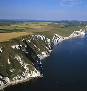
Aerial image of White Nothe, on the Jurassic Coast, UNESCO World Heritage Site, Dorset, England, United Kingdom, Europe
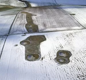
Aerial image of Normanton Down Barrows in snow, consisting of a Neolithic long barrow and Bronze Age round barrows, Wiltshire, England, United Kingdom, Europe
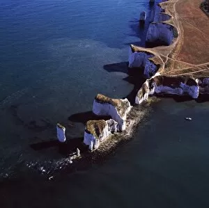
Aerial image of Old Harry Rocks, chalk stacks located directly east of Studland, north of Swanage, Dorset, England, United Kingdom, Europe
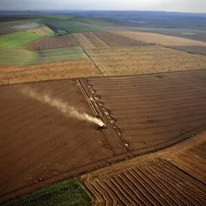
Aerial image of fields and harvest, Wiltshire, England, United Kingdom, Europe
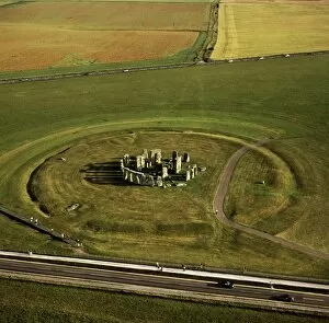
Aerial image of Stonehenge, prehistoric monument and stone circle, UNESCO World Heritage Site, Salisbury Plain, Wiltshire, England, United Kingdom, Europe
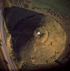
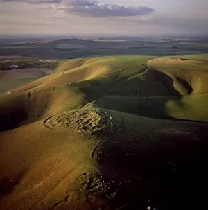
Aerial image of Beacon Hill, an Iron Age hill fort, Burghclere, Hampshire, England, United Kingdom, Europe
Aerial image of round and square Barrows at North Down in rape field, near Calstone Wellington, Wiltshire, England, United Kingdom, Europe
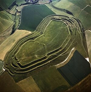
Aerial image of Bury Hill Fort, Wiltshire, England, United Kingdom, Europe
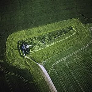
Aerial image of West Kennet Long Barrow, a Neolithic tomb or barrow, on a prominent chalk ridge, near Silbury Hill, Avebury, Wiltshire, England, United Kingdom, Europe
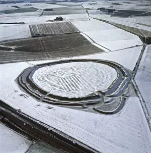
Aerial image of Yarnbury Castle, a hill fort, in snow, Wiltshire, England, United Kingdom, Europe
Aerial image of Maiden Castle, an Iron Age hill fort, Winterborne Monkton, near Dorchester, Dorset, England, United Kingdom, Europe
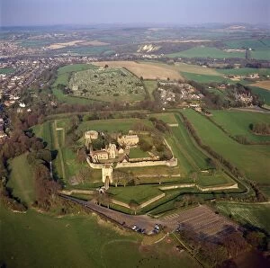
Aerial image of Carisbrooke Castle, a historic motte-and-bailey castle, Carisbrooke, near Newport, Isle of Wight, England, United Kingdom, Europe
Aerial image of Rybury Camp, an Iron Age hill fort with Neolithic causewayed enclosure, Wiltshire, England, United Kingdom, Europe
Aerial image of a pig farm, Wiltshire, England, United Kingdom, Europe
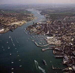
Aerial image of Cowes, on the west bank of the estuary of the River Medina facing the smaller town of East Cowes on the east bank, Isle of Wight. England, United Kingdom, Europe
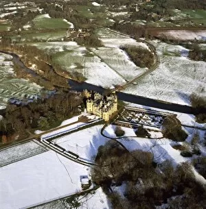
Aerial image of Longford Castle in snow, south of Salisbury, Wiltshire, England, United Kingdom, Europe
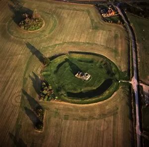
Aerial image of Knowlton Henge, a Neolithic henge monument, and Knowlton Church, a ruined Norman church, Dorset, England, United Kingdom, Europe
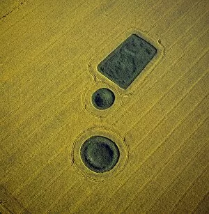
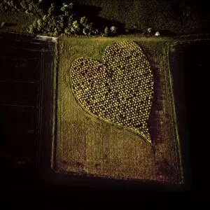
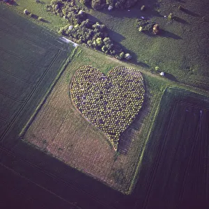
Aerial image of heart shape orchard, near Huish Hill earthwork, Oare, Wiltshire, England, United Kingdom, Europe
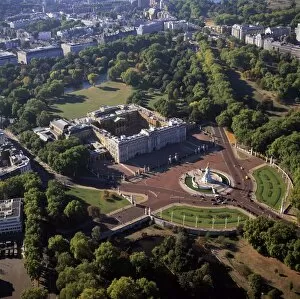
Aerial image of Buckingham Palace, City of Westminster, London, England, United Kingdom, Europe
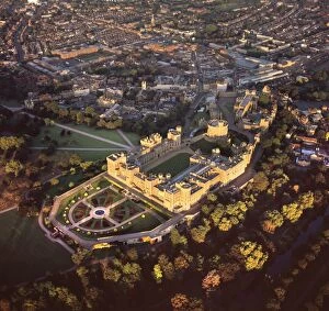
Aerial image of Windsor Castle, the largest inhabited castle in the world, Windsor, Berkshire, England, United Kingdom, Europe
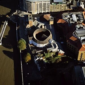
Aerial image of the Globe Theatre (Shakespeares Globe) and the River Thames, London, England, United Kingdom, Europe
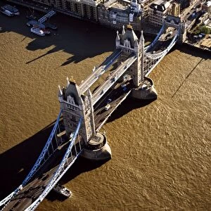
Aerial image of Tower Bridge, a combined bascule and suspension bridge, over the River Thames, London, England, United Kingdom, Europe
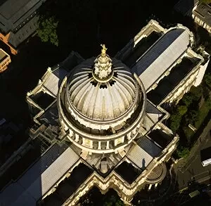
Aerial image of St. Pauls Cathedral, Ludgate Hill, City of London, London, England, United Kingdom, Europe
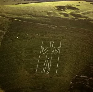
Aerial image of the Long Man of Wilmington, Wilmington, East Sussex, England, United Kingdom, Europe
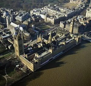
Aerial image of the Houses of Parliament (Palace of Westminster) and Big Ben, UNESCO World Heritage Site, Westminster, London, England, United Kingdom, Europe
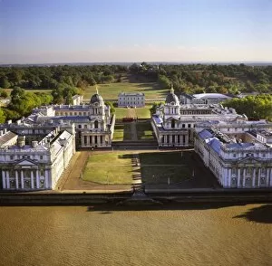
Aerial image of the Royal Naval College and Queens House, on the south bank of the River Thames, UNESCO World Heritage Site, with the Royal Observatory in the background, Greenwich, London, England
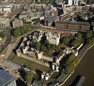
Aerial image of the Tower of London, UNESCO World Heritage Site, London, England, United Kingdom, Europe
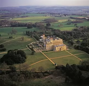
Aerial image of Osborne House, Isle of Wight, England, United Kingdom, Europe
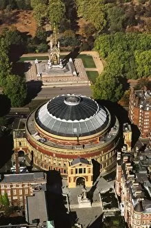
Aerial image of the Royal Albert Hall, and the Albert Memorial in Kensington Gardens, London, England, United Kingdom, Europe